South Coast Follies: Coastal Profiles of Nine Southern States

Southern Exposure
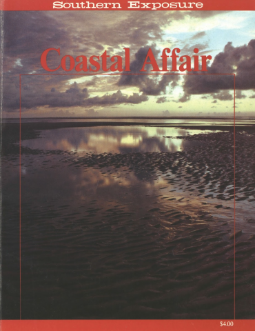
This article originally appeared in Southern Exposure Vol. 10 No. 3, "Coastal Affair." Find more from that issue here.
When we broached the subject of a coastal South book, our friends reacted with a classic, “Oh Boy! The beach!”
Then, when we trotted out a few horror stories, examples of serious threats to this scenic region, faces fell. “You mean there’s more to the beach than a good time?”
Yes, there is more — and in the following pages we focus on the critical conflicts coastal people face in the South Atlantic and Gulf states. Although some follies are common to all coastal areas, and ecological systems do not really stop at state lines, we have profiled the brackish region of each state separately: its unique history, indigenous culture and natural features, and its own special problems which often reflect official policy toward coastal resources and residents.
Here, then, is the bad news, along with much detail for the curious and the concerned, and a few success stories that illustrate what coastal advocates can do when they work together.
VIRGINIA
By Bud Watson, with thanks to Dr. Milton Reid
Virginia’s coastal zone, known as the tidewater, is dominated by the nation’s largest and most productive estuary, the Chesapeake Bay. Formed over the last 15,000 years as the rising sea flooded the low coastal plain at the mouth of the Susquehanna River, the Bay unites Atlantic tides with the freshwater flow of five major river systems and numerous tributaries, draining over 64,000 square miles in six states.
The Bay also separates the largely agricultural Eastern Shore peninsula from the rest of Virginia and provides an inland avenue for commerce and recreation. The two major Bay ports, Norfolk and Baltimore, rank fifth and sixth nationally in total tonnage. Though other ports are scrambling to catch up, Norfolk’s port is by far the nation’s leading coal exporter, handling over 53 million tons in 1979. A pleasure fleet of some 150,000 craft competes for space with the 7,500 ocean-going commercial ships and 10,000 local commercial vessels which ply the Bay each year.
On the Bay’s western shore in Virginia lie three large peninsulas, separated by the Potomac, Rappahannock, York and James rivers. From earliest times, the length and width of these rivers isolated the peninsulas’ fishing and farming communities. Now new residents, often still called “Come Heres” by old-timers, constitute an economic elite of retirees, second-home owners, metropolitan commuters and the new business owners who service their needs. Concentrated on the scenic water’s edge, the Come Heres have displaced fishing families but left the interior of the Tidewater peninsulas much as they were before the leisure and recreational boom: agricultural, forestal and often impoverished.
The Eastern Shore, even more isolated from mainstream Virginia life than the western shore peninsulas, has remained economically dependent on truck farming, poultry, corn, soybeans and seafood. Migrant workers harvest the truck produce, while local low-income people, particularly black women, work part-time in the seafood processing plants. The Chesapeake Bay Bridge-Tunnel, built in the mid-1960s, did not bring on the tourist boom its backers expected but has reduced the day-to-day isolation from mainland Virginia for those who brave the $18 round-trip fare to work in the Norfolk area.
To the south and west of the Bay’s outlet into the Atlantic sprawls the booming urban Tidewater area: the port cities of Norfolk, Newport News, Portsmouth and Hampton; the tourist centers of Williamsburg and Virginia Beach; and a host of other rapidly growing cities and towns. Over a million people reside in urban Tidewater, making it one of the largest metropolitan areas in the coastal South. Expansive port-related industries — including the state’s biggest industrial employer, Tenneco’s Newport News Shipbuilding and Drydock Company, manufacturing plants, 20 military installations, associated private firms and a burgeoning tourist industry — are the driving forces of the area’s economy.
The shallow Bay’s mix of fresh and salt waters sustains valuable spawning and nursery grounds for a variety of marine life. Oysters and crabs are the most famous of the Bay’s seafood delicacies. About 20 million pounds of oysters are harvested annually, more than any place else in the nation. Some 3,500 Virginia seafood harvesters, augmented by an equal number of part-time commercial fishers, brought in oysters, crabs, finfish, clams and scallops worth $65 million at dockside in 1978, and about 7,000 additional workers in the production and wholesale marketing segments of the industry increased the gross income value of the catch to about $100 million.
Virginia’s traditional laissez faire attitude toward growth management has contributed to some of the major problems facing its coast. Take for example the lax water pollution control measures in the Hopewell area (the self-proclaimed “Chemical Capital of the South”) that were intended to help industrial production. Ultimately, this resulted in Allied Chemical’s 1976 kepone disaster which closed the James River to commercial fishing for five years and, because the James River flows into the Bay, caused massive public fear and distrust of all Virginia seafood.
Or consider what happened when state government tripped over itself to expedite a 1974 plan by Cox Enterprises, the Atlanta-based communications conglomerate, to go into the oil refining business at Portsmouth. Like other state agencies, the Marine Resources Commission approved the refinery’s required permit, even though its own investigation indicated that serious harm to the Bay seafood industry was a likely result of oil spills associated with refinery operations. The Army Corps of Engineers’ environmental impact study indicated that Portsmouth was probably the worst site for a refinery on the entire East Coast, largely because of its proximity to irreplaceable seed oyster beds. Other federal agencies, particularly the Fish and Wildlife Service, strongly opposed the refinery. Ultimately, though, the decision rested with the Secretary of the Army, top commander of the Corps, who, under pressure from then-Governor John Dalton, approved the final permit in 1979.
After watching this process incredulously, a number of groups filed lawsuits. The Virginia Oyster Packers Association lost a suit in state court against the Water Control Board and the refinery. Citizens Against the Refinery’s Effects (CARE), a spirited Norfolk group, some of whose members lived downwind from the refinery site, filed four federal lawsuits over the air and water issues and engaged in a five-year process which, along with litigation by the Chesapeake Bay Foundation and the National Wildlife Federation, continues to delay construction of the refinery.
As a result, the Norfolk and Western Railroad, which had initially sold the refinery site to Cox Enterprises, sued Cox to get it back, and the state passed legislation allowing much of the site to be condemned for a state-owned coal port. Apparently, export coal has displaced oil as the latest coastal economic bonanza.
Virginia adheres strictly to a constitutional rule, known in legal circles as Dillon’s Rule, which limits local powers to those specifically granted by the state. Only the state has planning powers, and it has steadfastly refused either to use them or to delegate them to the localities through enabling legislation. Indeed, like Georgia and Texas, the state shied away from the national coastal zone management effort and in 1976 simply abolished its Division of State Planning.
Without growth planning, multimillion-dollar assessments of environmental deterioration — financed by taxpayers everywhere — are merely measurements, not mandates for action. The Environmental Protection Agency’s $25 million Chesapeake Bay Program study, for example, concluded that the Bay’s productivity is severely threatened by siltation and nutrient over-enrichment from upland development and agricultural runoff, and by industrial and residential pollution. The EPA Bay Program called for innovative management practices to stem the decline of marine life. But the study will be largely wasted unless planning and growth regulation are applied to Bay problems. Thus far, Virginia’s response to the program’s suggestions has been scant.
This ostrich-like stance is held in place not only by a general legacy of distrust toward government regulation, but also by a peculiarly Virginian alliance of old families, business interests, state government and the courts, operating in a vacuum of local power and leadership serving the public interest.
The cumulative weight of many unregulated small-scale developments in coastal Virginia — such as housing, shopping centers and marinas — has fouled water, closed shellfish beds and troubled the recreation and tourist industries. Virginia Beach, for example, has grown so rapidly that even local boosters admit it has become a sprawling, non-functional community with little relation or attention to the values that caused people to come in the first place. Much of the formerly renowned oyster beds in nearby Lynnhaven River have been condemned. Even public access to the water, except at the highly developed beach proper, is generally poor.
The issue of beach access, particularly ocean beach access, deserves special mention. Virginians are barred from the Atlantic coast by both geography and land ownership patterns. The distance around the Bay to the Eastern Shore, the time and toll dollars required to get there, and the fact that the private, nonprofit Virginia Nature Conservancy owns 13 of the 16 islands fringing the Atlantic border of the Shore and Emits access to them because of their inherent fragility, leave few available openings for the general public.
On the northern end of the Eastern Shore, the tourist center of Chincoteague and the Assateague Island National Seashore do offer accommodations and ocean access for millions of beachlovers. Indeed, this site is in many respects a model development, with all private businesses located behind the main barrier line of Assateague Island, thus avoiding the usual problems of erosion, pollution and private property conflicts caused by construction on the oceanfront.
The lack of sufficient access to the ocean’s water seems a small inconvenience compared to another problem: inadequate water supplies. Urban Tidewater’s population has endured year-long restrictions on water use, largely due to growing industrial and residential consumption and sorely limited supplies. Many Norfolk-area residents believe the dwindling supply is the result of drought, not overuse, and others have accepted these and similar dilemmas as the price one pays for enjoying the second highest weekly earnings in the state, short of Richmond.
A good income builds complacency, no matter what your color, and today many blacks in the urban Tidewater fit what Dr. Milton Reid, publisher of the Journal and Guide, Norfolk’s black weekly newspaper, calls “the mold of conservatism.” Attracted by steady jobs in the shipyards and high-paying industrial trades, rural blacks from North Carolina and Virginia moved to the area in large numbers during and following World War II. Their white-sponsored security mollified defiance. Says Dr. Reid, “The ’60s never happened in Norfolk. There wasn’t much of a mass movement here.” The Norfolk School Board is currently trying to abandon school busing to achieve racial integration (because it costs too much, they say), and only a small core of people are fighting the plan. After court-ordered desegregation began in 1972, whites fled Norfolk, many of them lighting in the Virginia Beach or other waterfront areas. With the Norfolk school system already majority black, activists are predicting that if school busing for racial balance is curbed, the city’s black youth will be resegregated in under-financed schools.
The price of job security becomes even more suspect as the tidal wave of industrialization ebbs. In early 1982, when the Norfolk Ford plant laid off its third shift, workers were sorely pressed to find other jobs. Even with the increasing defense budget and the numerous military facilities in the Tidewater area, unemployment is steadily climbing. Though area economists predict a turnaround by mid-’82, the lesson remains that there is no job security when multinational corporations and an elastic defense budget dictate the local marketplace.
Virginia’s governor as of 1982, Charles S. Robb, is in a position at least to consider local alternatives for economic development. Robb owes his narrow margin of victory over his Reagan-Republican opponent to black voters, 97 percent of whom supported him. Facing a close race, Robb also courted numerous public-interest groups, including coastal conservationists, and even issued a position paper on environmental affairs, another rarity in Virginia politics.
Accordingly, Robb has indicated a willingness to increase local government planning and growth management authority, to appoint more balanced interests to state environmental boards and to pay attention to the employment needs of the economically disadvantaged.
Robb’s supporters are now waiting to see if he delivers. So far, a basic question in coastal Virginia — the “jobs versus environment” debate — has in truth never been addressed. Instead, local people are faced with a choice between an oil refinery and more coal ports. Two coal terminals in the Norfolk area are being upgraded; and four new coal terminals are either planned or under construction. There is intense competition among ports from Baltimore to Galveston for this trade. The Norfolk channel is to be dredged an additional 10 feet to a 55-foot depth to accommodate huge coal ships, and state/ federal dredging permits are being “fast-tracked,” forcing environmental concerns again to take a back seat to industry.
Ironically, relatively few new jobs — 1,500 at the most — would directly result from the public capital expended in Virginia’s coal port mania. Considering that the estimated price tag for the dredging project is $1.8 billion and that four new coal terminals would cost some $450 million, far more jobs could be created if comparable public and private investment went toward light manufacturing, small businesses and other industries compatible with the natural resources of the area. To date, the state Division of Industrial Development has given no indication that it compares the job-creating potential and long-term environmental side effects of stimulating non-renewable, capital-intensive industries to the benefits of assisting indigenous industries, including tourism and seafood businesses.
This governmental responsibility to evaluate alternative futures is important everywhere, but particularly crucial in fragile coastal zones like Tidewater Virginia.
NORTH CAROLINA
By Todd Miller with Robert W. Oast; thanks to North Carolina’s Office of Coastal Management staff
In the summer of 1981, North Carolina Governor James B. Hunt and officials from Peat Methanol Associates of Santa Fe, New Mexico, stood before a crowd of reporters to announce that the world’s first peat-to-methanol plant was coming to one of the state’s northeastern counties. The plant will employ about 200 people and utilize peat being mined from vast coastal wetlands by several “superfarm” corporations.
This and other well-publicized development projects along North Carolina’s coast have changed the way people there live, work and interact with their natural environment. The 20 counties which border salt water still contain only 10 percent of the state’s population, but four of them are gaining new residents at two to six times the rate of the state as a whole, largely because of a boom in several retirement and resort beach areas.
The resurgence of public and private interest in North Carolina’s coastal area follows nearly 150 years of decline in the region’s economic, if not political, importance to the state. Geography alone can take much credit for the area’s slower development. Like a skinny arm off its Virginia shoulder, North Carolina’s Outer Banks hang southward and seaward for over 100 miles — with only one break, at migrating, treacherous Oregon Inlet — before turning back toward the mainland at Cape Hatteras, 30 miles offshore. Another long stretch to Cape Lookout is broken in several places by shallow inlets that have opened and closed over the decades. From that point south to the border, the islands hug the mainland, shielding it from the ocean’s force. While the Outer Banks are too narrow for much crop cultivation and therefore did not participate in the inland slave culture, they did support scattered villages of whalers and fishers.
Between the barrier islands and the mainland are about 4,500 square miles of shallow sounds, bays, tidal creeks and salt marshes. Pamlico Sound is the nation’s largest body of water behind a barrier island. Altogether, the state’s inland coastal waters comprise an estuarine system second in size only to Louisiana’s in the lower 48 states. Inland from these fertile, sea-life producing waters are seven major river systems bordered by brackish and freshwater wetlands, and fertile farm and forest lands.
Mainland high and dry enough for farming was divided up by European settlers in the mid-1600s, following a series of bloody confrontations with Indian tribes. An earlier, friendly welcome to the first English colonists is still replayed in Paul Green’s “The Lost Colony” outdoor drama on Roanoke Island. Inaccessible terrain and legislative restrictions on the size of holdings kept North Carolina from following the pattern of huge plantations set by Virginia and South Carolina. But by 1776, enough exceptions to the 660-acre limit had been made in the fertile tobacco and cotton region to spawn a slave-owning aristocracy which dominated state government. This concentration of power brought the state to the brink of revolution in 1831, when the state constitution was changed to give more clout to the far more numerous small farmers who took pride in their economic and political independence.
By 1860 over a third of the state’s people were slaves on coastal plantations. After the Civil War, plantations became tenant farms or were run on a sharecropping system that kept laborers in constant debt. Most of the state’s leading industries — textiles, tobacco and furniture — bypassed the coast for the Piedmont, which had water power and transportation and which drew bankrupt farming families into a growing industrial workforce. It was not until 1875 that an active fertilizer and lumber industry took root along the Cape Fear River near Wilmington. The city itself was a mecca for free blacks, and a fusion of black Republicans and Populists held control of its government long past the end of Reconstruction. In 1898, the white Democrats made their ultimate move to regain the region, declaring martial law, abolishing the duly elected local government and murdering scores of citizens, most of them black, in what is now known as the Wilmington Massacre. Once in command, the architects of Jim Crow spread terror and segregation throughout the region.
Many coastal areas still reflect their long history of economic extremes and cultural isolation, but numerous changes have occurred in the last several decades. The construction of two major military installations in the 1940s, increased tourism and second-home development, the emergence of corporate agribusiness, and expanded industrial activity have increased the region’s population and changed coastal life for many North Carolinians. By 1976, the coastal region had attracted an estimated 83,690 recreational properties alone. It is not unusual for recreation and retirement towns, like Nags Head in Dare County and Emerald Isle in Carteret County, to contain two or three times as many houses as permanent residents, and to be governed by condominium and beach cottage developers. Although beaches to the high-water tide line are public in North Carolina, many of them are now de facto private property because parking and pedestrian access is increasingly restricted by local governments and property owners. Fortunately, much of North Carolina’s Outer Banks is national seashore and wildlife refuge, and thus protected from private development.
Approximately half the land in the 20-county region is devoted to commercial timber growing. This acreage includes small private woodlots managed by corporate foresters, state and national forests leased to the corporations, and the thousands of acres directly owned by Weyerhauser, International Paper, Union Camp, Champion Timberlands and Georgia-Pacific. State economists estimate that $91 million in revenues was generated through the sale of forest products in 1979, revenues that provided jobs to approximately 5,800 people. However, since the North Carolina General Assembly changed the tax law in 1973, these companies have not been required to pay county property taxes on the value of their standing timber, thus dramatically reducing the tax base of many counties. For example, Gates County, where 22 percent of the population is poor, lost one third of its tax base.
Political and economic benefits from the coast’s old and new resources are also evenly divided. In some coastal counties, particularly in the northeastern section (not on the barrier islands), Afro-Americans are the majority (over 50 percent in Gates and Bertie counties and almost 50 percent in five other counties), yet their strength in numbers has not resulted in more than minor political representation. Income levels in high-percentage black population counties are lower than the already low coastal average, with over one-third of the citizens in Bertie, Hyde and Tyrrell counties living below federal poverty level standards. In 1979 the average Hyde County worker labored for $85.66 a week, the lowest wages in the state.
Farming remains a principal moneymaker in the region, but a decreasing number of coastal residents earn their primary income from farming; total cash receipts from farm marketing reached almost $400 million in 1978, but only 3.6 percent of the region’s workers list themselves as employed on farms.
State ports in Wilmington and Morehead City, although usually operating in the red and requiring large state subsidies, still contribute to economic development. The banks of the Cape Fear River near Wilmington have the heaviest concentration of coastal industry, including chemical plants and a small oil refinery; and over 1,000 people are employed by Texasgulf in phosphate mining and associated manufacturing in Beaufort County, where efforts to extract the fourth largest phosphate deposit in the world are enhanced by economical barge transportation down the Intracoastal Waterway to ships at Morehead City.
The fast-growing market for U.S. steam coal in European countries is seen as a new income source for the two ports. In April, 1981, Alla-Ohio Valley Coals, Inc., began exporting coal from Morehead City, and nine even larger coal export terminals are proposed, two for Morehead City and seven for Wilmington. But citizens in towns along the coal trains’ route to the sea are growing concerned about dust, vibration, noise and traffic disruption, with Morehead City drivers complaining about hour-and-a-half delays at the railroad crossing near the port when the trains were unloading.
Just as opposition to expanded coal operations was intensifying, Alla-Ohio shut down operations — having overextended itself into temporary bankruptcy — and began to reorganize. Even so, continued outside interest in the coal export potential of Morehead City has scientists and citizens worried that water quality will be degraded by runoff and groundwater leachate from coal piles and machinery, construction of coal terminals in low, sandy areas, and dredging to deepen the harbors for larger coal ships.
Similar concerns have led many to reassess the benefits of Texasgulf’s mining. Withdrawals of over 100 million gallons of ground water a day, necessary to keep the phosphate pits from flooding, caused area wells to go dry and raised concerns that municipal wells in large portions of the coastal region might be threatened by shortages or saltwater intrusions. Moreover, even though the mining has provided jobs, it has also brought new residents to fill those jobs, new demands on public services and even proposals to displace the entire town of Aurora to allow extraction of phosphate beneath it. Growing skepticism about local benefits from corporate phosphate mining recently made it politically acceptable for the Beaufort County Board of Commissioners to reject Texasgulf’s plan to mine the Pamlico River bottom until a study determined how mining would affect the river.
Vast estuaries and coastal waters support the state’s commercial and sports fishing industry. North Carolina fishers have shipped a wide variety of shellfish and fish to markets, first on steamboats and sailing vessels which crisscrossed the sounds to connect with the railroads, and today on refrigerated trucks, most of which head north to major population centers. Since the mid-1970s, the state and federal governments have spent $7.3 million to make North Carolina’s small-scale commercial fishing industry more efficient and competitive by constructing a seafood industrial park, dedicated in 1981 ceremonies led by Governor Hunt at Wanchese Harbor (see related articles on pages 7-15.)
The state’s Division of Marine Fisheries estimates that sport and commercial fishing now generates approximately $1 billion in revenues; more directly, the catch brought $57.5 million in 1981 to fishers at the docks. The highly decentralized commercial fishing industry employs some 20,000 fishers and workers, with a gross product of $300 million. It also sustains numerous tiny towns and barrier island communities of mostly moderate- and low-income people. On the barrier islands, the once-isolated fishing villages where residents spoke a thick Elizabethan brogue are now a mix of old-timers and new beach cottage owners, tourism businesspeople and realtors.
Deteriorating water quality seriously threatens North Carolina’s fisheries. Malfunctioning septic tanks — primarily associated with resort development and runoff from urban, suburban, agricultural and commercial forest lands — have contaminated 317,000 acres of oyster and clam beds, degraded estuaries essential to the survival of 90 percent of the seafood resources in the state, and spurred scientists to warn that a hepatitis outbreak is possible. Hardest hit thus far have been the fishers of Brunswick and New Hanover counties (near Wilmington), where pollution has closed a majority of shellfish acres (84 percent in Brunswick and 58 percent in New Hanover).
And now North Carolina’s largest and most productive estuaries are in jeopardy. Four superfarms are uprooting and burning vegetation and draining excess water throughout a low-lying, 648-square-mile area in the Albemarle-Pamlico peninsula to grow crops, raise livestock and strip-mine peat deposits. Developers of these farms include the John Hancock and Prudential Insurance companies and Malcolm McLean, a resort developer, ex-trucking magnate and founder of the highly successful Sea-Land Containerized Shipping lines. According to a U.S. Geological Survey study, rapid runoff of fresh water into Pamlico and Albemarle sounds is harmful to fishery resources; that is not news to those who depend on the resource. In 1976, one fisher, Troy Mayo, helped collect 3,000 names on petitions protesting large-scale drainage and carried the protest to the state capital; with characteristic distrust of government experts, he told a reporter for the state’s Sea Grant newsletter, “The bureaucrats and educated fools can’t see what’s going on without a study. But you can ask the stupidest person in Hyde County and he’ll tell you. The damage has been done in the past 10 years by the big corporate farms.”
Five years later, the state’s Marine Fisheries Commission finally publicly expressed its own strong reservations about the effect of the superfarms’ freshwater drainage into the estuaries. The commission’s statement, though, was overshadowed that same day by Governor Hunt’s announcement that the $250 million peat-to-methanol plant would be located on Malcolm McLean’s First Colony Farm, requiring the mining of at least 633,000 tons of peat a year.
The need to guide coastal development and protect natural resources was formally recognized in North Carolina when saltwater protection legislation was passed in the 1960s. Then, in 1974, at the height of the environmental movement in the United States, the state’s General Assembly passed a Coastal Area Management Act. The law has four main features. First, it creates a Coastal Resources Commission which holds public meetings every six weeks to make policy decisions and hear permit appeals. Eleven different interest groups, including commercial fishing, agriculture, forestry, real estate and banking, are represented, and each of the 15 members are nominated by county or municipal governments, subject to the governor’s approval. The act also sets up a 47-member Advisory Council to represent all levels of state and local government.
Second, counties must and cities may prepare land-use plans and policies for future development. Implementation of the plans is not mandatory, but they must be considered whenever state and federal permitting, funding and development decisions are made.
Third, certain places are classified as “areas of environmental concern.” These include parts of barrier islands and estuarine waters and wetlands, but exclude freshwater wetlands, inland portions of barrier islands, plus coastal farmlands, commercial forests and many other ecologically connected land forms where certain types of development can damage the larger system.
Finally, the act requires commission permits for development in “areas of environmental concern”; this procedure rarely prohibits development but rather attempts to head it in more environmentally sensitive directions. Intense lobbying of coastal-area legislators by real estate and industrial development interests succeeded in watering down the act with several dozen revisions to the original version. After its passage, proponents of the Coastal Area Management Act were concerned by the bill’s weakening, but saw it as a good beginning. Seven years of planning and regulations have generated a good deal of debate — and thus education — among coastal residents and their officials. But, according to Office of Coastal Management staffer Ralph Cantral, “Building a constituency for an environmental program in these days of tight pocketbooks is extremely difficult.” North Carolina’s coastal management program is often cited nationally as a model for other states, but coastal management officials live in continued fear that if they get too tough on development the program will be cast away by the General Assembly.
Attempts to locate a huge, potentially explosive liquefied petroleum gas storage facility and two oil refineries on the state’s coast, plus the phosphate mining, the superfarm clearing-draining projects, coal export developments and rapid resort development of unprotected barrier islands have all served to ignite public interest in the future well-being of this region. The Conservation Council of North Carolina, Carolina Coastal Crossroads at Wilmington and Carteret Crossroads in Morehead City/Beaufort, N.C. Land Use Congress, Neuse River Foundation and the Pamlico-Tar River Foundation are among the citizen organizations seeking to make coastal development more environmentally sensitive. Aided by the forum provided by the Coastal Resources Commission, these voluntary groups, even though limited by lack of funds, have focused public attention on development projects that are highly controversial in nature. In rural areas, though, citizens are poorly matched against well-financed development interests.
Whether North Carolina’s citizens like their coastal management program or not, it is a “good beginning” that allows public participation and local government control to a greater extent than is found in other Southern states. The goal of the act — “To insure the orderly and balanced use and preservation of our coastal resources” — and its provisions are vulnerable to misuse by powerful forces interested in short-term profits. Yet the program also holds great promise if supported and influenced by people with foresight who care about the future quality and economy of their coast.
SOUTH CAROLINA
By Bob Hall, Todd Miller and Robert W. Oast
All of coastal South Carolina can be divided into three parts. From the North Carolina border to Winyah Bay, the crescent-shaped “Grand Strand” has few barrier islands but enjoys broad beaches and thick dunes. Anchored by Myrtle Beach, the 50-mile stretch is the fastest growing section of the coast and is rimmed with motels, carnival-style attractions, 30 golf courses, 12,000 campsites, older communities of oceanfront cottages and a maze of new condominiums.
Tourism, South Carolina’s second largest money-maker with $2.2 billion in 1980 revenues, has long centered in the Grand Strand; and the area still draws half the seven million out-of-state visitors, including hordes of college students and over 50,000 Canadians each spring. The strain on the 45,000 local taxpayers to provide adequate public services for 300,000 vacationers on a typical summer day is considerable. Young families are being priced out, yet Myrtle Beach offers tax breaks to new property owners over age 65, another factor helping South Carolina attract the third highest proportion of retirees among the states.
The recent emphasis on luxury retirement condominiums has also changed the pluralistic character of Myrtle Beach, an area that got its major commercial boost after World War II and again in the booming 1960s. “In a class sense, the new development is limiting,” says Dr. Charles Joyner, a Grand Strand native who now teaches history at USC’s Coastal Carolina College. “When I was growing up here, there were many classes although we all spoke with the same accent. People speak with all sorts of accents now, but it is all one class.” The interior of the Waccamaw region, meanwhile, remains working class and largely farming and forest land, with Horry County (population: 101,000; 75 percent white) leading the state in agricultural production, chiefly tobacco and soybeans.
The coast’s second section begins at Georgetown and Winyah Bay and continues for 20 miles through the Santee River delta, the largest river delta on the East Coast. It includes the 20,000-acre Tom Yawkey Wildlife Center, the 17,000-acre Baruch Foundation properties, the 24,000-acre Santee Coastal Reserve, the 31,000- acre Cape Romaine National Wildlife Refuge and a chunk of the Francis Marion National Forest — altogether an unparalleled vista of protected beaches, forest lands and marshes that are home for hundreds of thousands of birds and such endangered species as the loggerhead turtle, bald eagle, short-nosed sturgeon, and Eastern brown pelican.
Before the Civil War, the freshwater areas here and in the Waccamaw region supported the state’s wealthiest, most slave-intensive rice plantations, while the breezy, saltwater lowlands hosted summer retreats for planters up and down the coast. Much of the land passed to Charleston and Columbia merchants during Reconstruction and later to Northern financiers, timber companies and private hunting preserves. Even in areas deeded to the public, hunting clubs still hold special privileges to use state-maintained rice impoundments for duck blinds. Forty percent of the marshes of the Santee delta are impounded, and large sections of the interior are part of the three million acres of coastal zone timberland, mostly owned by the big paper companies.
The inlets, bays and coastal waters make the area a center for South Carolina’s fishing industry, which grossed $26.5 million in dockside landings in 1979. Some $2 million came from clams and oysters, and over $20 million came from harvesting shrimp. The Army Corps’ project to re-divert the Santee River back to its original course will wipe out the clam and oyster beds at the mouth of the old river, says Tommy Duke, a local boat captain and operator of Bulls Bay Seafood in McClellanville. During the New Deal, the Corps shifted the Santee’s flow to the Cooper River as a means of flood control; but now the Corps wants to move it back to reduce siltation in Charleston harbor. Some shellfishers who rely on the beds at the Santee’s mouth are bitter about the change, but the increased river flow could yield improved subtidal oyster beds in the long run. Whether the benefits ever outweigh the loss “is just anybody’s guess,” says Duke.
Below Bulls Bay, the southern section of the coast features a string of stubby sea islands, separated from the mainland by marsh, tidal channels and inlets. Some, like Capers and Hunting, are partly or entirely publicly owned with restricted access; some, like Johns and St. Helena, are populated by descendants of slaves who initially received land from Gen. Sherman (see pages 35 and 100); some, like Sullivans and Folly, are older beach villages, predominantly of whites; and some, like Seabrook and Hilton Head, are modern enclaves for the very rich.
With Charleston at the center, this region nurtured an extremist culture of privilege and privation that in too many ways continues today. Its roots go back to Pedro de Quexos, a slave trader who sailed into what was probably Winyah Bay in 1521 and left with 150 Indian captives for the Spanish plantations in the West Indies. In 1664, Capt. William Hilton dropped anchor at an island he named in his honor and recorded his amazement at the area’s oak-forested islands and abundant fish and fowl, ideal conditions for colonization. “The ayr is clear and sweet, the country very pleasant and delightful,” he wrote. “And we would wish that all they that want a happy settlement of our English nation were well transported here.”
In 1670, the English settled along the Ashley and Cooper rivers and began importing slaves, first from the West Indies and by 1700 directly from Africa. A “pest house” on Sullivans Island, just off Charleston harbor, became a quarantine center for thousands of Africans entering the New World. The new workers, bringing knowledge of rice cultivation with them from West Africa, were forced to build an expanding system of ditches and embankments along a 50-mile strip of tidal swamps. Later many rice fields and additional lands were transformed into indigo and cotton plantations, yielding spectacular wealth.
Muggy weather and fear of malaria led planters to spend much of the year elsewhere, at Mt. Pleasant or McClellanville, in Newport, Rhode Island, in the mountains, or enjoying the fashionable life of Charleston. In 1824, Charleston boasted more carriages than any other city in the U.S.; upper-crust ladies, observed Mrs. Nathaneal Greene, “spent half their time making their toilets, one-fourth of the remaining time paying and receiving social visits, and another fourth in scolding and hitting the servants.”
While blacks were less susceptible to malaria than their white masters due to sickle-cell trait, they too sought ways to change conditions or leave the region, often by boat. A settlement of free blacks grew outside St. Augustine, and the slaves who organized the dramatic Stono Revolt near Charleston in 1739 were marching to join them when they were overpowered. Similar plots, real and imagined, triggered violent reaction from planters who cherished the belief that slavery was natural, even preferred by their captive workforce.
In 1775, for example, the provisional government killed Thomas Jeremiah, one of the free blacks who routinely piloted boats in and out of the Charleston harbor; the freedom fighters said Jeremiah was conspiring with a British warship to smuggle arms to the slaves, so they burned him at the stake in downtown Charleston.
Denmark Vesey was a slave in the West Indies at the time, but he won his freedom with a lottery ticket and became a prominent free black carpenter in Charleston. In 1822, he was hanged with several co-conspirators for plotting to free the city’s enslaved majority.
A few months later, the state legislature authorized the creation of what became the Military College of South Carolina (the Citadel) “to establish a Competent Force to Act as a Municipal Guard for the Protection of Charleston and Vicinity.” In the defense of the planters’ way of life, cadets from the Citadel assembled on a harbor island on January 9, 1861, and fired the first shots of the Civil War on a federal ship bringing supplies to troops at Fort Sumter. Today, the school is one of only two all-male, publicly funded military colleges in the nation and symbolic of what writer Pat Conroy calls Charleston’s “seige mentality” and “conviction that the twentieth century is a mistake.”
The legacy of a plantation ethos is evident throughout the low country — in the casual use of the term “plantation” to describe the new resorts; in the preoccupation of prideful preservationists in Charleston and Beaufort; in the high incidence of white-only private academies; and, most remarkably, in the persistence of a tradition of paternalistic, authoritarian “masters” who determine the destiny of their chosen home turf.
The latter includes such modern-day master politicians as Mendel Rivers, a man who represented Charleston in Congress for 30 years and who left the district with 10 naval and other military installations, enough to make the Pentagon still the area’s largest employer.
And the tradition includes Charles E. Fraser, Jr., a master of development strategies whose Sea Pines Plantation pioneered the resort island concept. In 1969, Fraser led a coalition of resort owners, black fishers from Hilton Head and environmentalists against the location of a German chemical company, BASF, on Port Royal Sound. The state government and the Beaufort-area black community and Chamber of Commerce heavily courted the $200 million plant, but with the use of anti-pollution laws, court suits, intense lobbying and promises of alternative economic development, Fraser’s coalition prevailed and BASF abandoned its plans.
Ironically, five years after Fraser helped environmentalists block the German chemical firm, he championed a plan by Arab investors from Kuwait to convert pristine, virtually uninhabited Kiawah Island into a sumptuous seaside resort. The Sierra Club, Audubon Society and Charleston’s sizable Jewish community opposed the project, but Fraser and his associates, who had the contract to manage the development, lined up support from Charleston and neighboring Johns Island blacks like Bill Saunders, who said, “The environmentalists are just a bunch of upper-middle-class white people who care about birds and turtles, but they never mention the poor people of Johns Island.” On the day of the public hearing for zoning changes on Kiawah, Fraser got the U.S. Assistant Secretary of Treasury to call the head of the Charleston County Council to explain how increasing Arab investment in the state was in the national interest. The changes were adopted and development on the island commenced.
Four years later, on August 12, 1980, “Kiawah officials were as content as alligators in the shallow ponds on the islands’ hard-to-reach areas,” wrote Keith Schneider in the Charleston News and Courier. On that one day, they sold $10.2 million in real estate, even though the prime interest rate hit 20 percent. That same season, a quarter acre of Fraser’s Sea Pines Plantation oceanfront property sold for $375,000. But although Bill Saunders had landed a top job with the Kiawah Development Co., many other blacks on the sea islands and the rest of the low country were losing their land and still waiting for the promised prosperity from resort development (see articles on pages 33-39).
Beaufort County, which is 33 percent black and includes Hilton Head Island, ranks 34th among the state’s 46 counties in average weekly wages, consistently exceeds the state’s unemployment rate, and employs half its nonagricultural workers in low-paying service and trade jobs; but because of the resort island rich, the county shows up having the second highest per capita personal income in the state. Jasper County, on the Georgia line, ranks 45th; its population —14,500 — is 57 percent black, one fourth the size of Beaufort County, and mostly engaged in agriculture, fishing and timbering.
Development strategies are sparking disputes on other parts of the coast as well. The town of Georgetown, which serviced the early rice plantations, opted for industrial development in the 1920s and ’30s and underwrote the construction of International Paper’s giant pulp mill in its downtown. Some say the mill’s sulfur odor and the metallic dust from Georgetown Steel’s smokestacks have prevented the surrounding area from attracting tourist development. But the union wages at both plants have helped the sagging economy of a county that was majority black until 1970.
With chronic unemployment — now at 19 percent — and a declining port, city leaders welcomed a 1979 plan by Carolina Refining and Distributing Co. to locate a 30,000-barrel-a-day refinery on Winyah Bay. On the other hand, Zane Wilson of Georgetown Advocates for Rational Development points to the adjacent wildlife refuge areas and valuable fishing industry, and says the inevitable oil spills and pollution “are not worth accepting in exchange for 60 or so jobs from a refinery.” Investigative reporter Jan Stucker found a half-dozen major errors or problems with the company’s numerous filings in the last two years, but state regulators have given the refinery a green light with only two or three permits to go.
“It’s all political,” says Betty Spence of the South Carolina Wildlife Federation, which is suing the South Carolina Coastal Council for granting the permits required under the state’s coastal management law.
According to Stucker and others, the “undisputed power” behind the project is James B. “Jimmy” Moore, vice chairman of the state Port Authority, which owns the land where the refinery would be located. Moore is a former legislator, a powerful Georgetown County Democrat and attorney for Carolina Refinery. He has convinced Sen. Strom Thurmond to help him keep the Army Corps of Engineers from preparing an environmental impact statement (EIS). Bo Bricklemyer of the Center for Lowcountry Environments says environmentalists have formally requested an EIS on the refinery since January 1979. But the Corps has not budged; its South Carolina office has earned a reputation as “the worse in the Southeast.” If it eventually grants the refinery a permit without doing an EIS, more lawsuits will surely result. Moore and his friends are incensed at the prospect of delays, especially since they see the project as the key to upping the economic benefits side of a cost-benefits equation which could justify federal improvements of the harbor.
The pro-development bias of the South Carolina Coastal Council, which oversees the coastal management plan, is equally infuriating to environmentalists, many fishers and coastal residents. “The little guy who can’t afford the right law firm may not get a permit,” says Bo Bricklemyer. “But the well endowed with connections can still get what they want. In many cases, the Council doesn’t follow its own rules.”
One recent example involves a longstanding desire by Graham Reeves of the Georgetown-area Annandale Plantation to build a series of dikes around 660 acres of marsh near the mouth of the Santee for duck ponds. Despite his questionable legal claim to the land and data showing the impoundments would damage valuable estuaries and block 14 large streams in the area, the Coastal Council’s review committee recently granted Reeves a permit. The Natural Resources Defense Council, the South Carolina League of Women Voters and state Attorney General (who is concerned about private infringement of public trust land below mean high water) are now challenging the permit.
Up at Murrell’s Inlet, the Council is allowing the construction of a marina for commercial and sports fishing boats, despite residents’ vigorous opposition to further development in their coastal village and fears that increased boat traffic will harm existing shellfishing in the area. Meanwhile, state and federal grants and permits for additional Charleston port facilities on the Wando River now threaten one of the most productive estuaries in the state.
Boosters of coastal development have been slow to acknowledge the consequences of their shortsightedness. Steady erosion and hurricanes have taken the first line of houses on Folly Island’s beach. In late 1979, residents held workshops on proper coastal management; but a few weeks later, the city council granted building permits for a 540-unit condominium project on the island’s southwestern tip. A loud outcry followed and the Audubon Society threatened a lawsuit. “Anyone who visited the site could see it was a dubious venture at best,” said the Society’s W.C. Blakeney, noting that the proposed access road to the property would be often under water at high tide. Anti-development publicity helped limit the company’s pre-construction sales after four months to only 18 units. It finally dropped the project and its option on the land. In a pleasant victory for beach and nature lovers, the area was subsequently purchased by Charleston County for a public beach and park.
Those who need an extra nudge before the lessons sink in might stand at Charleston harbor and gaze upon a lighthouse surrounded by water that was once far inland on Morris Island. Years ago, eager engineers erected two five-mile-long jetties at the mouth of the harbor “to maintain a safe channel for vessels.” The jetties’ disruption of normal sand shifts along the coast hastened the erosion of Folly Island and eventually left the Morris Island lighthouse several thousand feet from its shore. And the harbor channel still fills in.
GEORGIA
By Albert Scardino and Marjorie Scardino, with research assistance from Cathy Schulze and Peter Wood.
As the Gulf Stream passes by the Georgia coast 65 miles offshore, it creates a gentle backwash that flows south along the state’s sea islands. The winter storms that blow out of the northeast combine with the longshore current to lift the sand from one beach and carry it southward to the next, each island feeding the next one in the chain, their shapes changing slightly with each season.
The shoreline of Georgia’s 100-mile coast itself changes much more dramatically than the shape of the islands, but that shifting takes longer than a season. The continental shelf slopes very gently here, so a change of 10 feet in sea level can push the shoreline 10 miles in or out. Some 220 million years ago, the ocean washed against the present-day fall line at Augusta and Macon and Columbus, 150 miles inland. During the coldest epochs of Earth’s history, when the ice caps absorbed much of the ocean’s waters, the coast of Georgia stood 100 miles further out to sea.
This constant change from land to water to land occurs every day, too. Twice each day, eight-foot tides flood 425,000 acres of marshland behind the sea islands and twice each day the marsh re-emerges as land. As land, Georgia’s salt marshes are three times as productive as the richest Iowa corn field. As water, they provide a nursery for shrimp, crabs, fish and oysters. The plant and animal life in this subtropical wilderness includes a diversity and abundance found in few other places: bald eagles and peregrine falcons, loggerhead turtles and whales of various types, dozens of different kinds of crabs and hundreds of different kinds of butterflies and moths, marsh grasses and live oaks and lichen, to name a few.
A band of salt marsh five-miles wide separates Georgia’s sea islands from the mainland, insulating them from many of the changes of the past 100 years. Archaeological records suggest that the first residents of Georgia’s islands moved here shortly after the islands emerged from the sea, about 8,000 B.C. Some of the larger and more stable islands have yielded pot shards and shell middens 10,000 years old.
The Spanish happened on the islands in the early sixteenth century while searching for gold in the Caribbean basin. After preventing French Protestants under Jean Ribaut from obtaining a foothold on the southern coast, they set up Catholic missions on St. Catherine’s, Sapelo and Cumberland islands. Franciscan friars offered the blessings of Christianity to the Guale Indians in exchange for forced labor and cultural submission. Indian workers in mission villages raised food and citrus crops to sustain the foreigners and to support, through a very heavy corn tax, the permanent Spanish settlement in Florida.
In 1597 a Christian Indian named Juanillo from the island of Guale (St. Catherine’s) led the first recorded anti-European revolt in North American history. Distressed over the customs, controls and diseases brought by the Europeans, the Indians brutally killed the Spanish soldiers and most of the missionaries in the region.
Fearing rebellion would spread southward, the Spanish governor retaliated quickly, destroying the offending villages and permitting his soldiers to enslave the able-bodied men and women. New friars soon returned to the area, but the unprofitable missions were finally abandoned during the early seventeenth century. The names of some of the rivers and islands — St. Mary’s, St. Catherine’s, St. Simon’s — are all that remain of the Spanish presence.
The English settlement of Georgia began with James Oglethorpe’s founding of Savannah in 1733. Oglethorpe proposed to create a self-sufficient colony of artisans, craftsmen and laborers. He banned lawyers, rum, slaves and Roman Catholics from his utopia and created a scheme of housing and gardens that gave each settler a small stake in the colony. He proposed to build this new order on a silk industry; but after 20 years, Georgia’s silkworms and mulberry trees had produced no more than 1,000 pounds of cloth in any one year.
Oglethorpe and his trustees reverted to the South Carolina plantation model, legalizing race slavery to attract new investment to keep the colony alive. Britain’s king, George II, offered grants of land — most of them small parcels of high land surrounded by hundreds of acres of marsh — to attract British aristocrats to the colony. The aristocrats brought slaves from South Carolina, the West Indies and then directly from Africa to dike the marshes and create rice fields.
For the rest of the eighteenth century, the rice plantations provided enough commerce for the colony to survive, but not to prosper. Georgia’s planter society remained a poor imitation of its neighbor across the Savannah River in South Carolina. Then in 1793, Eli Whitney invented the cotton gin during a visit to a plantation on the Savannah River. His mechanical device for separating seed from fiber made cotton a more valuable crop, and its popularity spread across the coastal plain from the islands toward Alabama and the Southwest. Slave laborers dug canals and built railroads to haul cotton from the fields to the rivers and then to the port of Savannah, which mushroomed from a frontier town of 3,000 residents in 1790 to a rich trading center of 15,000 by 1850.
For the next 75 years, the plantation culture of the Tidewater region dominated Georgia’s politics, economy and society. But the state’s political power and its economic strength slowly shifted inland. By 1840 the land speculators and yeoman farmers of the Piedmont and mountain counties had driven the Cherokee and Creek Indians out of the state and shoved the Seminoles into Florida. New railroads connected the cotton fields with the new textile mills of the Piedmont, bypassing the swampy coast, and the more competitive world of small farms and giant mills bypassed the stratified life of the Tidewater plantations.
By the time William T. Sherman marched into Savannah during the last months of the Civil War, the cotton trade was in shambles. Rather than burn the city as he had Atlanta, Sherman sent a message to President Lincoln: “I beg to present you as a Christmas gift the City of Savannah.” After he had toured the abandoned cotton fields of the coast, he decided to make another gift of land, this one to the newly emancipated workers who had lived on the coast for more than a century.
On January 16, 1865, with the approval of the Secretary of War, Sherman designated the entire sea island region from Charleston to the St. John’s River as an exclusively black settlement. The former slaves were to receive “possessory” titles to these lands stretching back 30 miles from the coast, and black refugees from other areas would be allowed to take up property there in 40-acre tracts. Special Field Order 15 guaranteed federal protection to the occupants “until such time as they can protect themselves, or until Congress shall regulate their title.” The order stood for three years; then President Grant rescinded it as part of an agreement to bring Georgia back into the Union.
Many of the former owners of the plantations returned to their homes, and white investors from the North took up new tracts, but the agricultural base of the coastal economy had already died. Land which had sold for $5,000 per acre when it grew long-staple cotton before the war was not worth much without captive labor to produce the crops. The price of island land dropped to $50 per acre, and it stayed there for more than 80 years.
Freed slaves formed small communities on Ossabaw, St. Catherine’s, Sapelo and St. Simon’s islands, growing vegetables and harvesting oysters, shrimp and crabs. The landowners harvested the pine and oak from the primitive forests to feed the sawmills on the mainland and left the islands to take care of themselves.
While the rest of Georgia moved on into the twentieth century, the mainland of coastal Georgia wallowed in an economic depression. The collapse of cotton prices in the economic panic of 1893 and the arrival of the boll weevil took away the cotton trading that had made Savannah rich. Though cotton accounted for more than half the total value of Georgia agricultural products until 1920, its dominance of the coastal economy was over.
Logging operations generated just enough timber and naval stores to keep the ports of Savannah and Brunswick open. The rest of the coast became a winter resort as America’s wealthiest industrialists acquired the islands — Carnegies on Cumberland, Fords and Wannamakers on Ossabaw, Rockefellers and Vanderbilts on Jekyll. Rice fields became duck ponds for hunters; field hands became guides and caretakers.
By the time the Great Depression grabbed hold of the rest of the United States, coastal Georgia had already lived through 10 years of economic hardship. Then, in 1932, Charles H. Herty matched Eli Whitney’s technological miracle by devising a way to manufacture paper from Southern pine trees. Union Bag and Paper Company moved from New York to Savannah to open a mill on the Savannah River in 1936.
The new plant hired 400 workers the day it opened, and by the end of the decade it employed more than 10 percent of the county’s work force as it grew to become the largest paper mill in the world. The new paper industry sucked 20 million gallons of water per day out of the limestone aquifer that supplies water to the coast — as much as the rest of the city of Savannah consumes in a day — drying up wells 20 miles away. (See article on water resources, page 40.) Union Bag and the 10 other paper companies that followed it to the area during the next three decades quickly destroyed what was left of an agricultural economy along the coast. Trees require less tending than other crops, and the rural agricultural towns boarded up their storefronts.
As the cities of the Piedmont boomed after World War II, Savannah lost nearly 20 percent of its people, and the coast became a vast tree farm. Union Camp Corporation (as the company is now known) acquired more than 800,000 acres of south Georgia pine forest, most of it concentrated in the sparsely populated counties along the coast.
With their control of so much real estate, the paper companies — particularly Union Camp, Brunswick Pulp and Paper and Gilman Paper — have steered development toward well-to-do communities. Since 1970, Union Camp’s own subsidiary, the Branigar Organization, has created a community of 3,000 residents on Skidaway Island, eight miles southeast of Savannah, using 3,100 acres the company acquired in 1941 for $50 per acre. When Chatham County built a bridge to the island in 1968, six families lived there. The county planning commission projects that the population of Skidaway will reach 20,000 within 20 years. A marsh-front acre on the island now sells for $125,000.
What the paper companies don’t own on the Georgia coast, the federal and state governments do. The U.S. Army has 20,000 troops at its Hunter Army Airfield-Fort Stewart complex, and the reactivation of old Fort Stewart has boosted the population of Bryan County from 6,539 in 1970 to 10,175 in 1980. Similar growth will occur at King’s Bay on the other end of the coast, where the U.S. Navy is building a base for the Atlantic fleet of Trident nuclear submarines. King’s Bay covers 16,000 acres in Camden County. The Navy says that more than 7,000 active duty personnel and 18,000 family members and civilians will be stationed there by 1990 — nearly five times the current number of residents in the county. In fact, the sparseness of that population led the Navy to choose the site in 1975, given the need to isolate the nuclear reactors aboard the submarines and explosives on the loading docks from population centers.
The U.S. Interior Department owns more than one-fourth of Georgia’s beaches, including the national wildlife refuges on Wassaw, Blackbeard and Wolf Islands, and 22,000 acres on Cumberland Island, a national seashore accessible only by boat. Other federal wildlife refuges and military installations from the Okefenokee Swamp to Tybee Island cover more than 400,000 acres.
The state of Georgia owns two of the largest islands, Sapelo and Ossabaw. Sapelo serves as a marine science research center for the state university system, and Ossabaw is home to an artists’ and writers’ colony operated by a private foundation under the auspices of the state Department of Natural Resources.
Since 1976 the state has also claimed ownership of Georgia’s 425,000 acres of salt marsh because for 12 hours each day they are coastal waters rather than coastal land. This claim arose in 1968 when Kerr-McGee Corporation, an Oklahoma minerals company, acquired title to a cluster of small islands and the surrounding marsh 15 miles east of Savannah. The company had located a deposit of phosphates 30 feet below the surface and wanted to strip-mine the marsh and islands. The state’s control over the marsh has survived two court challenges, but Kerr-McGee still owns the islands. A rise in the price of fertilizer could bring new proposals for mining the deposits.
Although the state government in Atlanta has achieved some degree of control over coastal land use, the political affairs of the coastal region remain very independent. The ethnic rainbow which makes up Savannah’s population — Irish, Greeks, Italians, Russian Jews and the more typical Southern black and white Protestants — has no parallel anywhere in the state.
Neither does the insularity of Savannah’s politics. From the last wave of Irish immigration in the 1870s to the Civil Rights Movement of the 1960s, the Irish Catholic vote dominated coastal politics. As long as the local Irish machine delivered its votes to the proper state politician, the machine could run its own affairs. But no one from the coast has been elected to statewide office for nearly 100 years.
By the mid-1930s Savannah had become known as the Free State of Chatham County, generally ignoring state liquor and gambling laws and receiving far less than its proportional share of state funds for roads, schools and hospitals. The isolated counties along the coast existed as smaller versions of the same thing; in some poor communities the largest industry was often a speed trap catching tourists bound for Florida.
The independence of local politicians often translates into antagonism toward state and federal governments. Georgia refuses to participate in the national coastal zone management program, and local political leaders have refused to pressure the paper mills to correct their pervasive “rotten egg” stench.
State and federal taxpayers shelled out $4 million in 1975 to pump enough sand onto Tybee Island’s eroding beach to give vacationers something to play on. In exchange the town was to provide more parking spaces for day visitors. But after the Corps of Engineers did its part, Tybee reneged and then added insult to injury by allowing the part-time town attorney to construct a hot dog stand on the new sand dunes.
Tybee’s antagonism toward government doesn’t stop with state or federal officials. Even at the municipal level, the town prefers random placement of hundreds of new condominiums to any kind of zoning. Zoning means government interference in private development, according to the Tybee town council, and so the island has accepted 500 new apartments in 18 months without regard for how the town can provide water, sewer and garbage service for the new residents — much less schools, libraries and health clinics. The volunteer fire department is not equipped to fight fires in buildings higher than three stories, yet three of the biggest new condominium projects stand five stories or more.
Lack of planning and intergovernmental coordination could erode Tybee’s future. The state has invested more than $250 million in the past five years to develop the Port of Savannah as a bulk commodities export terminal and as an import center for containerized freight. Ship traffic has increased 30 percent to 150 vessels monthly since 1977 and state officials expect another 20 percent increase over the next five years. All that activity could help justify the cost of deepening the harbor from its present 36 feet to 45 feet. And the dredging could, in turn, interfere even more with the coastal currents which move sand from beach to beach, thus increasing Tybee Island’s erosion problem. An identical conflict is developing at the Port of Brunswick and the public beach at Jekyll Island State Park, which is located just south of the Brunswick channel entrance.
Although Georgia’s coast is short compared with its neighbors’, its marshes and mudflats produce an abundance of shrimp, crabs, oysters, clams and fish. The state’s fishing industry, like that of the Carolinas, is composed mostly of independent operators who have little control over prices paid by dealers or over ill-advised government strategies to “manage” the fisheries. Because it takes four years for an oyster to mature and state regulations only permit two-year oyster bed leases, Georgia oysterers have never worked to ensure a future crop, having no assurance they will be able to lease the same site in future years. Consequently, only one person applied for a commercial license to harvest oysters in Georgia in 1981 and, despite the fact that the state grows some of the most succulent ones in the country, local markets mostly receive oysters from Apalachicola Bay, Florida.
The shrimping industry did well in 1979, bringing in six million pounds in a year when a light catch in the Gulf of Mexico drove prices very high, but by 1981 the state catch had fallen to some two million and the price had come down 25 percent. Two severe winters in a row had killed off most of the young shrimp in the marshes. The number of operators obtaining a license to shrimp fell 35 percent between 1979 and 1981.
In addition, the under-employed shrimp fleet became a shuttle service for drug smugglers: a state crime task force reported in November, 1981, that smugglers imported $6 billion worth of drugs through Georgia’s coast in one year. Since 1980, an average of one public official in the southeastern part of the state — from deputy sheriffs to city managers — has been arrested or indicted on drug charges every 19 days.
Georgia s coast has ridden a series of economic booms and busts. Gold for the Spanish, silk for the English and rice and cotton for the planters all offered a promise of wealth, but each of these phases of development faded after a few generations, and the wilderness erased most of their traces. The changes brought on by the paper companies and the military are much more extensive and long-lasting, but they have helped to ensure that the Georgia coast will remain much more sparsely populated then those of her neighbors, which should in turn protect the area’s natural wealth — its wilderness and the diversity of life that the wilderness supports.
FLORIDA
By Dan Stroh with Terry Pierson and Jennifer Miller; thanks to Charles McCoy, Richard G. Hamann and Shirley Taylor
In 1775, naturalist William Bartram visited Florida and pitched a tent “under the shelter of a forest of Live Oaks, Palms and Sweet Bays. . . . Our repose however was incompleat, from the stings of mosquetoes, the roaring of crocadiles, and the continual noise and restlessness of the seafowl, thousands of them ... in such incredible numbers, that the trees were entirely covered.”
This wilderness soon fell victim to colonizers’ attempts to subdue it — especially after it became United States territory in 1822 — and Florida’s long history of official boosterism began in earnest. Successive state assemblies interpreted public-land management to mean land bestowment, and by 1899 Florida had offered private corporations considerably more land than the state ever possessed. The principal beneficiaries of this largesse — the railroads — got land grants of as much as 20,000 acres per mile of track.
The man most responsible for the course that east coast development took was Henry M. Flagler, a Connecticut native whose early fortunes were made as a partner in Standard Oil. He turned his land grants and tracks running from Jacksonville to Miami into the Florida East Coast Railway empire, which by 1908 included a string of luxury hotels that could accommodate 40,000 guests. At age 75, Flagler set out to conquer the very tip of Florida. Seven years, three hurricanes and 700 lives later, the Overseas Railroad pulled into Key West in 1912.
Once the wilderness was opened, tourists and immigrants poured in. And if Florida — really just a thin layer of land on a limestone shelf — wasn’t exactly as promised, then Florida could be changed. At Miami Beach — in 1910 a narrow barrier island, sloping away from low sand dunes into a great thicket of mangrove-covered tidal flats — developer Carl Fisher employed black laborers, working knee-deep in mud and breathing clouds of mosquitoes and sandflies, to clear a thousand acres of mangroves and fill the swamp with six million cubic yards of mud dredged from the bay bottom.
By the early 1920s, two million tourists were visiting the golden coast each year. These were the state’s boom years. Though the bubble burst temporarily in 1926, the ’20s land grab gave Florida an expanded transportation system and a doubled population in only six years. The lure of warm climate and waterfront property continues, as does the pattern of overall expansion and boom-bust cycles — all of which promise to make Florida the nation’s fourth most populous state by the year 2000. In the last decade alone, Florida grew four-and-a-half times faster than the country as a whole.
No part of this peninsular state lies more than 70 miles from the sea; even so, 80 percent of its population crowd into the coastal counties, leaving much of the interior to agribusiness, cattle, timbering, phosphate mining, tourist attractions and lakeside fantasy. The steady surge of development has spread along the string of accessible barrier islands hugging the Atlantic Coast mainland from Georgia to Miami; the flashy Palm Beach-to-Miami corridor, for example, is home to more than a third of the state’s 10 million people. Down the peninsula’s thin tail to Key West are a string of coral and limestone islands or “keys,” home to 60,000 Floridians.
Across the southern mainland is a wide, slow slope of sawgrass and cypress, the Everglades and the Big Cypress Swamp. After a century of drainage projects, only half the Glades remain, and water levels are so depleted that the soil often burns down to bedrock in dry periods. Northern portions of the swamp have been turned into large vegetable farms employing tens of thousands of seasonal farmworkers, many of them Haitians, Jamaicans and Mexican Americans. The flow of vital fresh water to the estuaries of the Everglades National Park has been diverted to quench the thirst of agriculture and South Florida metropolises.
In the Ten Thousand Islands area on Florida’s southwestern coast, oyster bars and red mangrove trees gather passing silt into tiny new islands; some now under development are only decades old. Beginning south of Sanibel Island and continuing to St. Petersburg is another series of heavily developed barrier islands.
The pressure of newcomers (retirees arrive in Florida at a rate of 8,000 to 15,000 per month, according to a federal study) is compounded by the flight from the state’s troubled urban areas to the rural towns and fishing villages which until recently had constituted “the Other Florida.” Northward to the Panhandle stretch salt marshes and tidal creeks that are now in the path of the spreading demand for waterfront property. At shallow Apalachee Bay, the coast bends sharply west to Apalachicola Bay and the crystal blue waters toward Pensacola. Here, the tiny town of Destin, at the mouth of the Choctawhatchee Bay on the Panhandle Coast, zoomed from 1,000 residents in 1970 to more than 6,000 in 1980, along with a seasonal population of 5,000. Like those of neighboring towns, Destin’s beautiful beaches have been “discovered” to the extent that even the local chamber of commerce president publicly moans, “Development is out of control.”
In south Florida, too, the “chamber of commerce” dream has turned sour. Along with water quality and supply problems, real estate speculation and a growing impoverished under-class, the area is besieged by rampant lawlessness. Miami, West Palm Beach and Fort Lauderdale each made the FBI’s 1981 list of the nation’s most crime-ridden cities, with Miami ranking number one in murders. The local and national press dwells unceasingly on the region’s crime problem, and a Time magazine cover story in November, 1981, all but told potential visitors that a vacation in south : Florida might cost them their lives.
The region’s proximity to Caribbean islands has made it the point of first sighting for vessels carrying human cargo — the “boatpeople.” Cubans and Haitians are the most visible and controversial of Florida’s recent immigrants. Almost a million Cubans have crossed the straits to settle in south Florida since Castro’s 1959 revolution. Well over a billion dollars in federal aid went to those who came in the 1960s and ’70s.
But when Castro opened the port of Mariel to anyone who wanted to leave in the spring of 1980, the crush of 125,000 exiting Cubans severely strained south Florida’s ability to absorb newcomers. Castro also opened the doors of Cuba’s prisons and mental asylums for the boat lift, exporting; increased crime and social problems to the area.
Years before Mariel, Haitian exiles and civil-rights organizations in south Florida and elsewhere were noting that the black boatpeople were treated differently from light-skinned Cubans. Of the 50,000 Haitians who have sought political refuge in the U.S. since 1972, fewer than 150 have been officially granted that status. (See the article on Haitian immigration, page 60.)
Meanwhile, in Miami’s black Liberty City community, the unemployment rate tripled in just over a decade and stood at 17.8 percent in 1978. By May, 1980, Liberty City erupted in the bloody riot that brought it much national attention but no improvement in economic conditions.
Despite all the national attention focused on south Florida’s troubles, tourism statewide still draws 35 million visitors spending $17 billion annually, and aside from Disney World the beaches are the main attraction. Yet 340 of the state’s 750 miles of ocean beaches are only slivers of what they used to be, because of destructive developments and erosion. An $80 million beach renourishment project in Miami Beach is only one of many planned for the state that will continually require hundreds of millions of tax dollars. (See the article on Florida’s beaches, page 24.)
Despite widespread perceptions to the contrary, heavy industry is also important to the coastal region’s economy. Much credit for the industrial wave must go to 11 major military installations in the coastal zone, where the Pentagon has forged a lucrative partnership with Pratt and Whitney Aircraft, IBM, Piper Aircraft, Honeywell, Boeing and other, smaller firms. Florida ranks seventeenth in the U.S. in generating hazardous wastes, 90 percent of which comes from nine coastal counties.
Florida also attracts another type of economic development: drug smuggling may now be the state’s leading industry. With ideal access to the source — Latin America and the Caribbean — coastal Florida has become the gateway for an estimated 70 percent of all marijuana and cocaine brought into the U.S. In south Florida particularly, drug money finances large sectors of the banking and real estate industries, as well as well-documented corruption among public officials and law enforcers. Some of Florida’s 10,000 fishers, too, have discovered that transporting bales of marijuana — known locally as “square grouper” — is far more profitable than netting mullet.
Commercial landings of fish and shellfish at Florida ports during 1977 were valued at $95.2 million dockside. Almost $45 million of that went to the capital-intensive shrimp fleets, yet the less valuable foodfish catch — particularly mullet — supplies a living to thousands more Floridians in small boats. In fact, in 1977 Florida led the South Atlantic and Gulf states in foodfish production, despite the “population boom, major destruction and alteration of its fishery habitat and numerous conflicts in the fishery that have been caused by social, political and biological concerns,” documented in a 1981 study by the state fisheries advisory council.
Half the nation’s stock of condominiums is in Florida. Conversion from rental units to condos is causing acute housing shortages in south Florida, and mobile homes are fast becoming the norm for the middle class in some areas. Lower-income people can’t even afford trailers. In Indian River County (Vero Beach), where one-fourth of the population lives in trailers, a citizens’ group has been pressing local officials and the state to discourage “unconscionable” rent increases; one man said his lot rent rose by more than 75 percent in one year.
Unscrupulous coastal development has created another, much more dangerous problem. Thousands of Floridians, many of them retired people who settled as close to the water’s edge as they could afford, are sitting ducks for floods and hurricanes. They live on artificial islets separated by finger-shaped canals or on barrier islands perched offshore — their only escape from disaster a 12-hour hurricane warning and a narrow bridge. Residents of the Keys are linked to the mainland by a two-lane road more than 100 miles long, glued together with dozens of bridges. On Tampa Bay alone, 65,000 people live on thin sand veneers dredged up from the bay bottom.
Since 1900, Florida has been hit by an average of one hurricane every year and a half, but the state has enjoyed a moratorium on major storms since the early 1960s. Because of the long respite, 90 percent of its coastal dwellings have not weathered a major hurricane, and the coastal areas are largely inhabited by people who have never experienced the high winds and storm surge that one brings.
Housing in “reclaimed” swamp areas carries special problems, too. When Tropical Storm Dennis arrived in 1981 amidst a two-year drought, it brought much-needed rain and flooded the east Everglades. Homeowners and farmers in that area were soon up in arms at the South Florida Water Management District for not draining the water off their lands. But, as a Miami Herald editorial writer pointed out, local, state and federal government agencies had 12 years earlier set “policy” that the area would remain wilderness and that development there would be discouraged. Development occurred anyway, vegetation was cleared, and the homes and farms periodically flood. Draining this area (west of Miami) would mean the loss of fresh water, already in short supply, which recharges Dade County’s aquifer. If not recharged, the aquifer suffers saltwater intrusion. (See water resources article, page 40.) The editorial concluded that the Glades’ new residents “should have known better.”
State environmental policy has been mixed. From 1972 to ’75, Florida enacted much progressive legislation, with Governor Bob Graham, then a state senator, as the conservationists’ champion. But in February, 1981, a Sports Illustrated story accused Graham of being a man with high political aspirations who had turned to industrialists and agribusiness for support. “The sad fact is that Florida is going down the tube,” the magazine claimed. “Indeed, in no state is the environment being wrecked faster and on a larger scale.”
Focusing on the development of environmentally sensitive areas, the article noted that Miami’s drinking water is among the most chemically contaminated in the country. Tampa Bay pollution has caused a drastic decline in its oyster population, with one section closed for swimming as well; the state sports the nation’s largest number of potentially dangerous hazardous waste sites (103 recorded) with no barriers to ground water; the state’s canals, along which housing and commerce cluster, are grossly polluted with coliform bacteria, such that “in many locations, Floridians have, in essence, run a hose from their toilet to the kitchen faucet.”
The Audubon Society, the Florida Conservation Foundation, the Florida Defenders of the Environment, Sierra Club groups and various local organizations are credited with stopping some of the degradation, on a never-ending case-by-case basis. Miami Herald columnist Al Burt once characterized Florida’s environmentalists as being fearful of espousing their true philosophy — that if growth continues in the state, the environment is doomed — “because somebody might shoot them or mash them flat with a bulldozer.”
Still, concerned citizens stopped a refinery project on Biscayne Bay, fought off development on the northern Keys, saved the Big Cypress Swamp as a national preserve, stopped the Cross-Florida Barge Canal Project in 1971 (though the canal is reportedly still on Congress’s active list), and more. But they worry that they’ve lost Graham to politics. Though some activists say he is still accessible to them, Florida Wildlife Federation head John C. Jones said in the Sports Illustrated article, “I can’t even get in to talk with him, and I run the biggest conservation organization in Florida.”
Word is that Governor Graham was so embarrassed by the negative national attention the Sports Illustrated article generated that within weeks of its appearance he persuaded his cabinet to deny Getty Oil a permit to drill a test well in Pensacola’s East Bay and began to talk about raising money to buy undeveloped natural areas and save the coast from “an impenetrable wall of construction.”
There are local battles as well. Apalachicola Bay produces 90 percent of all Florida oysters. Oysterers there, who are also local elected officials, moved to protect their multi-million-dollar fishery from an Army Corps of Engineers’ proposal to dam, straighten and dredge the huge river that feeds the Bay. Reams of studies conducted by Florida State University marine biologist Robert J. Livingston and an army of researchers concluded that the Corps’ economic justification for the project did not consider the damage to the Bay and the local livelihoods it supports. Backed by the experts, local citizens convinced the state to spend an additional $8 million to acquire river frontage and establish the Apalachicola River and Bay Estuarine Sanctuary, thus reducing the threat that development poses to commercial fishing.
In the last decade, some coastal Florida communities have begun to slow down or restrict their own growth. When the Gulf Coast island of Sanibel proved unable to cope with the consequences of expansion plans thrust upon it by far-removed Lee County commissioners, its wealthy residents decided to “secede” from the county. Sanibel incorporated as a town, drawing up a charter that placed high priority on the natural attributes that had attracted its residents in the first place. The new town even set a strict cap on annual growth and successfully defended the cap in court.
A state supreme court decision in June, 1981, signaled a cooling-off of Florida’s long and steamy love affair with developers. In Bob Graham, et al. v. Estuary Properties, Inc., the court upheld Lee County’s denial of zoning and development approval to a corporation planning a mammoth waterfront city near Fort Myers. The company’s blueprints called for 26,500 homes with shopping centers, marinas, boat basins, golf course and tennis courts — a typical new town in Florida that would have destroyed some 1,800 acres of black-mangrove-forested wetlands.
The county imposed 12 conditions on the developer, including lowering the density, reducing the amount of wetlands to be destroyed and protecting the water quality. Estuary Properties sued, and the highest state court finally decided that protecting an environmentally sensitive area and preventing pollution are legitimate concerns for public welfare and that these concerns are valid uses of a community’s police power, not an arbitrary “taking” of private property rights. Late in the year, the final hurdle was jumped when the U.S. Supreme Court refused to hear Estuary’s appeal and let the Florida ruling stand.
The decision sends a strong message to communities that they can close the door on developers and kick the “growth at any cost” habit — even in Florida.
ALABAMA
By Rebecca Paul, Frank Daugherty, Chris Mayfield and Terry Pierson
Alabama’s tiny coastland has always been dominated by the ambitions of its only big city, the port of Mobile. The state’s 48 miles of Gulf-front beaches are in high demand because of their proximity to this major metropolis, and the coastal estuarine lands and waters are called on to serve the conflicting needs of wildlife, fishing interests, residences, recreation and especially Mobile’s heavy industry.
Geographically, the area is complex, with its deltaic marshes abundantly fed by the confluence of two major river systems and more than a dozen tributaries converging at Mobile Bay; its barrier islands and long, narrow peninsula; and the coastal marshes of the Bay, Gulf and the Mississippi Sound.
The overriding importance of industry here aside, Alabama’s coastal region is rich: the Mobile-Tensaw River Delta is a complex ecosystem which has been placed on the National Register of Natural Landmarks; only a portion along the Mobile River is heavily industrialized. Three barrier islands stretch 19 miles along the state’s coastline, with only three percent of their acreage preserved from present and future development. And the coastal wetlands — 120,000 acres — support a wealth of plants and animals, including an estimated 90 threatened or endangered species of plants, fish, reptiles, birds and mammals.
The Mobile Bay itself, averaging 10 miles in width and running 33 miles to the Gulf, contains over 3,000 acres of oyster reefs. Along with other marine life dependent on estuarine waters and wetlands in coastal Alabama — mainly the highly valued shrimp populations — they support some 7,000 Alabamian commercial fishers. Like other natural assets in coastal Alabama, the wetlands and the oyster reefs suffer from growing industrial and residential pollutants which degrade water quality — already some 72,000 acres of shellfish beds have been closed to fishing because of contamination — and from more direct disturbances such as dredging and siting of developments in their midst. Even so, Bayou la Batre, a small fishing community west of the Bay and fronting the Mississippi Sound, ranks tenth in the nation in annual landings of shrimp, oysters and fish.
Historically, as well as geographically, Alabama’s two coastal counties are a region apart from the rest of the state. In fact, in 1907, when the state was considering a liquor prohibition law, the city of Mobile threatened to secede entirely, and more recently, state representative Tommy Sandusky renewed the proposal that Mobile and Baldwin counties join their regional compatriots on the Florida Panhandle and the Mississippi coast in forming a new Gulf Coast state.
Such proposals are based on cultural and historic connections with neighboring coastal areas that make the coast distinct. While the rest of Alabama was settled by people from further east, mainly Georgia and the Carolinas, the coast was first colonized by the French in 1702. By 1719 slave ships were bringing West Africans to Mobile to clear land for a small number of rice and indigo plantations. Descendants of the original settlers from France, Quebec and the West Indies and, more significantly, of the many waves of immigrants who came directly to the port of Mobile from Europe in the nineteenth century, still have more in common with neighboring Gulf Coast communities than with inland populations.
Like other Southern ports, Mobile had large and active German, Irish and Jewish communities; Greeks and Lebanese also settled in both coastal counties. Catholic institutions flourished under French and Spanish flags, and Mobile still has one of the largest Catholic populations in the South.
The local Indians — the Choctaws — were driven west in the early 1800s to reservations in Mississippi and Louisiana. Many of those who stayed in coastal Alabama intermarried with whites and blacks and are known today as the “Cajuns” of northern Mobile and southern Washington counties. These “Cajuns” bear no relation to the Louisiana Acadians, and many identify with the recently organized Mo-Wa tribe, now officially recognized by the federal government,
Mobile’s old families have long | maintained an interlocking network of I family and business interests that still holds sway. The wealthy live mostly in “West Mobile,” a sociological location as much as a geographical one. Today, due to massive white flight from the downtown district in the 1960s and ’70s, the mushrooming city extends from the Bay’s western shore to a ring of suburbs sprawling north and west toward the Mississippi line.
To the east, as well, portions of Baldwin County have become suburban white communities; median family income ($9,700 in 1975) increased in Baldwin in the last decade, while there was no appreciable increase in Mobile County. Less well-endowed white residents live on Mobile’s south side and in nearby fishing towns and countryside. And black citizens, who comprise a third of Mobile County’s population, are mostly concentrated in a swath of slums and a few suburban neighborhoods running north to the neighboring, majority-black city of Prichard. Through urban renewal, thriving black neighborhoods in downtown Mobile were razed in the 1960s, and new residential construction has been slow in coming.
The Mobile-Prichard black community’s rich cultural heritage has of late been the focus of an attempt to get national historic park status for AfricaTown, a community which traces its roots to an 1859 illegal slave voyage that landed America’s last recorded shipload of captive Africans. The community retained its distinct ethnic and tribal code of government, its traditional language and customs, until well into the twentieth century, but the cultural history kept alive for so long would have disappeared without concerted efforts by local black leaders.
Culturally rich but economically poor, blacks in coastal Alabama remain at the base of a political and economic system which increasingly benefits a small elite and a new population of skilled workers who move in with major corporations. Mobile’s ruling powers, particularly, have inhibited progress in black communities. For example, though recent downtown revitalization plans contained promises of housing rehabilitation and the possible creation of a historic district in the Davis Avenue area (the city’s largest black neighborhood), these plans were scrapped in January, 1982, when the city diverted the funds to fight drainage problems caused by development in West Mobile.
The contrast between rapidly industrializing Mobile and neighboring Prichard is especially startling. Some observers say Prichard resembles an impoverished Central American city. In 1970, its population of over 40,000 was half black and half white. By 1980, though, after a black mayor and mostly black city council were elected, white residents fled to northern and western suburbs and Prichard became three-fourths black. As the tax base dwindles, the city’s leadership has been hard-pressed to improve conditions for its citizenry: unemployment, crime, drug addiction and poverty are rampant, with a quarter of Prichard’s people using food stamps, compared to only one in seven in all of Mobile County.
Seasoned observers of the region say Alabama’s coastal population is unusually polarized along race and class lines, and racial tensions have not diminished even in recent years. Continuing social strife is one major result of the conflicts — so common and so critical in coastal areas — between the ambitions of politicians and developers and the needs of the indigenous population and the complex but fragile environment that supports them. In Mobile, as in other “booming” Sunbelt cities, unchecked and unplanned growth is rationalized by the “trickle-down” theory. But far from bringing in more jobs for its own poor people, the Mobile area’s recent boom has brought in outsiders to fill the mostly specialized jobs and the posh new residential communities. As a result, competition and animosity between the races periodically comes to a head, especially when swelled by the resurgence nationally of the Ku Klux Klan and other racist groups.
During the last couple of years, racial tensions have spawned a number of violent attacks against blacks, including the March, 1981, lynching of Michael Donald (see Southern Exposure, Fall, 1981) and several law-enforcement-related black deaths. Lack of national attention to these incidents, along with light coverage in Mobile’s daily newspapers and a weak and belated response by the local white community, have heightened anger and frustration in the area’s black communities.
The black citizens’ efforts to gain a foothold in the city’s political life had already suffered a major setback, when the U.S. Supreme Court ruled against them in the spring of 1980 in a landmark case, City of Mobile v. Bolden. The case dated from 1975, when a group headed by long-time Mobile civil-rights activist Wiley Bolden brought suit charging that the city’s at-large elections diluted black voting strength. The plaintiffs had high hopes because past cases in other cities had allowed blacks to demonstrate that at-large voting violated their rights by use of accumulated circumstantial evidence of racial discrimination, evidence of which was readily available in Mobile. But the Supreme Court ruled against Bolden, saying that circumstantial evidence of discriminatory effect was not enough; the plaintiffs must prove discriminatory intent. This decision, placing a nearly impossible burden of proof on the victims of discrimination rather than on its perpetrators, was a historic setback for voting-rights struggles everywhere.
Before World War II, the rural economy of Alabama’s coastal area centered on fishing, agriculture, shipbuilding and lumber. Lumber had replaced cotton as the port’s main export commodity in the 1880s, and in 1928, International Paper Company set up the first large manufacturing plant in the area. In the late ’30s, Alcoa, National Gypsum and several chemical companies were drawn as well by the port’s excellent transportation facilities, low taxes, abundant water supplies and cheap labor. The industrial work force was generally unorganized except in the older skilled trades like shipbuilding, carpentry and bricklaying. And all the unions — except the bricklayers, masons and plasterers — were segregated.
Industrial expansion on the state’s coast never really took off until 1964 when the Brookley Air Field — a major employer in the area — closed and was leased to the state port as an industrial complex. To cope with this blow to the local economy, the Mobile Chamber of Commerce created a “Task Force 200” to obtain $200 million worth of industrial development in five years. The group was so effective that it met its goal in a year and a half. To a large extent recruitment goals followed the lines of a 1960 Area Audit by the Southern Institute of Management that recommended, among other things, going after the chemical industry because of the area’s abundance of water and cheap transportation.
Another factor has been the controversial Mobile Industrial Development Board. The autonomous 13-member board has the power to issue tax-free bonds and grant property tax exemptions. Although Alabama law allows cities to retain ratification powers over such boards, the Mobile City Commission chose not to do so when it created the board in the 1950s. Between 1969 and 1979 the board issued more than $400 million in industrial development bonds. The county tax assessor is not even told how much property the board is removing from tax rolls, but has estimated that tax exemptions have cost some $8 million in revenue sorely needed for schools and human services.
From 1973 to ’79, chemical and allied industries accounted for nearly 80 percent of industrial investment in the coastal area. Already, 70 known solid waste disposal sites were operating without authorization in the two counties; major water quality problems have surfaced, particularly in the Mobile River and western portions of the Bay; Mobile ranks second behind Birmingham among cities in the Southeast in industrial/commercial particulate and sulfur oxide emissions into the air. The prevailing philosophy among Mobile’s leaders seems to be that the work of today is to recruit any and all industry, and the future will take care of itself. (See Robert Ratner and Jeffrey Rothfeder, “How High A Price to Win New Industry,” Floridian, St. Petersburg Times, December 16, 1979.)
Today, nearly 50 large industries are crowded around the port, with promise of more to come, particularly chemical firms and energy corporations. South of Mobile on the western shore of the Bay is the 4,000-acre Theodore Industrial Park, created in the mid-’70s, which has already attracted almost a billion dollars in industrial investments. The park is part of a larger harbor-improvement scenario spawned by the imminent completion of the Tennessee-Tombigbee Waterway — widely called “the granddaddy of Corps boondoggles” — which will connect the port with major industrial centers along the Ohio and Tennessee rivers now served by the port of New Orleans. (See Southern Exposure, Spring, 1980.)
The Tenn-Tom, scheduled for completion in 1986 at a cost of nearly $2 billion, has set off a gold-rush surge in Mobile’s business community. Aside from the chemical companies already bidding on sites along the waterway’s mouth, the chamber of commerce is banking on huge amounts of coal barge traffic from the Appalachian coalfields. These expectations are part of a national fever which even Fortune magazine calls “The Coal Export Gamble.” Coal terminals are being planned or built at 29 harbors from New York to Texas, with forecasters predicting that coal shipments to our allies — to “get them off OPEC oil” — will exceed grain exports by the year 2000.
All this new growth will make sharp demands on the Bay and surrounding wetlands, since the new industries will want sites near navigable waters. State port officials are already seeking hundreds of millions of dollars to dredge the 40-foot-deep Mobile Bay ship channel to 55 feet. A Reagan administration effort to cut back federal expenditures by imposing user fees on beneficiaries of harbor dredging projects has Mobile port officials extremely worried.
Dredging projects have severely disturbed the oyster reefs and marine life of Mobile Bay. Disposal of dredged materials has environmentalists fearful: the material contains toxic substances which have settled to the Bay bottom. Officials are hoping to use the dredge spoils to fill in 1,800 acres in the Bay adjacent to the Brookley Industrial Complex; the new land would be used for industrial sites.
Also looming on Alabama’s coastal horizon are recent oil and gas discoveries in Mobile Bay and offshore. Natural gas deposits were discovered in the Bay in 1979 by Mobil Oil Company, and in March, 1981, 13 large tracts in state waters were leased to eight oil companies. In addition, three major oil fields are in operation offshore, and one, the Citronelle Field, has produced 110 million barrels since 1955. Onshore refineries are imminent; Mobil Oil plans one in the Theodore Industrial Park, receiving crude natural gas piped through a 15-mile network of submerged pipes.
Because of the area s geography, industrial and residential growth brings special problems. Built on a low, sandy plain, Mobile has been subjected to flooding, as well as devastation by six of the 20 hurricanes which have pounded the Gulf Coast since 1900. Most recently, 1979’s Hurricane Frederic wreaked $1.7 billion worth of havoc. The land’s natural drainage abilities are not adequate to the task presented by overdevelopment.
The booming Eastern Shore area in Baldwin County is a case in point. At present, septic tanks handle most of the waste-water disposal, but as subdivisions multiply and industry moves into the county, the soil becomes oversaturated and bacterial pollution results. Since Baldwin is growing much faster than the rest of the coastal region — with a 31 percent population increase in the last decade — the situation can only worsen. Yet there is still no county-wide authority to coordinate waste-water management.
Drainage and pollution problems are even more acute on slim and scenic Dauphin Island, where development took off after an access bridge was built in 1955. By 1976, overpopulation (mostly seasonal) and overdevelopment had forced the Mobile County Board of Health to issue a moratorium on septic tank installation and new construction.
Hurricane Frederic imposed another building “moratorium” when it whipped the island with 145-milean-hour winds and destroyed most of the buildings along with the bridge. A subsequent controversial decision to rebuild the bridge with $38.5 million in federal tax dollars was a nice boost to Brown and Root (which has the construction contract) as well as island property holders and the 680 permanent residents. Critics of the new bridge point out that Dauphin Island is largely a playground for the rich, with only a half mile of beach accessible to the general public. (See the article on federal subsidies for island development, page 44.)
No community was harder hit by Frederic than the eastern peninsula beachfront town of Gulf Shores. Since the storm destroyed most of the free-standing structures there, the town has had a chance to plan for a safer, more sightly future as it rebuilds. But, though some citizens have initiated discussions along those lines, they are losing out quickly. An unprecedented building boom is exploding in this once-quiet Fishing and tourist community. Condominiums are springing up along the beach where single houses once stood, along with numerous new bars, fast-food restaurants and gift shops. In 1981 alone, about $31 million worth of new construction went up, compared to only $700,000 in 1977, and the town faces the prospect of becoming another overbuilt resort.
In one regard, Gulf Shores is better off than it was before the hurricane. Working in the area after the storm, the Federal Emergency Management Agency purchased and deeded to the town several beachfront lots that had been motel sites. As a result, the town now has some 12 miles of public beaches, far and away better than Dauphin Island’s one-half mile.
Efforts to stem the floodtide of resort and industrial development in Alabama’s coastal region are still mostly small-scale and fragmented. Black citizens’ groups in Mobile and Prichard continue to seek more political power and better human services in their cities, while small, fairly well-off, mostly white environmental groups seek protection of natural habitats. Members of the Mobile Bay Audubon Society are concerned about rapid industrialization along the Bay and raise determined voices at public hearings. And the Nature Conservancy recently saved from development a 1,290-acre tract on the Fort Morgan peninsula, subsequently turning it over to the federal government as a wildlife refuge. The U.S. Fish and Wildlife Service calls the tract the best remaining undisturbed beach ecosystem between Pensacola, Florida, and New Orleans.
Struggling against enormous monied opposition, new industrial arrivals, oil and gas development and an exploding population is Alabama’s Coastal Area Board, created in 1976 when the state joined the national coastal management program. A notable First effort at growth management, the program was crippled at the outset by its tentative legislative mandate. If the Coastal Area Board does what it is supposed to do — protect the coast’s natural resources by conditioning or denying industrial development permits — it may be knocked out completely by industrial growth boosters. Already in the spring of 1982, the legislature was voting to strip the board of its powers and move it to the state capital, effectively severing the coastal public from its main growth management and environmental protection tool.
Yet, there is much left to save. Off the causeways and along the remaining undeveloped coastlands, local people still enjoy abundant opportunities to drop a hook, launch small boats and watch sunset clouds paint splendor across the watery and marshy expanses. In this coastal area particularly — caught in a boom-or-bust craze only a few decades old — immediate, forceful citizen demand for planning and regulation seems the only hope for a healthy future.
MISSISSIPPI
By Cy Rhode and Bob Hall, with thanks to C. Paige Gutierrez
Coastal Mississippi is less like the rest of its state than perhaps any other coastal region in the South. Largely isolated from the agrarian economies which shaped the rest of Mississippi, the three counties along the Gulf are tied historically to Louisiana through the common roots of their settlers and through a connecting web of trade and travel routes.
Ships once entered the port of New Orleans by navigating across the Mississippi Sound; the east-west railroad line completed in 1869 and the Old Spanish Trail which preceded Highway 90 both provided wealthy New Orleans residents access to a handy retreat from the yellow fever plagues which troubled that city each muggy summer. This escape/vacation route gave rise to towns like Pass Christian, with its yacht club, its elaborate antebellum mansions and its relatively high black-to-white ratio — a reflection of the original servant-master households.
Today nearly 300,000 people live along the 70-mile-long coast; most of the population is packed into the nine coastal cities whose economies center largely on neon tourism, bustling port commerce and associated industrial parks, and government employment.
The legacy of the New Orleans connection is evident in many aspects of Mississippi’s coastal counties. Take the Catholic faith, for example: just east of the Louisiana line, half of the 25,000 people living in low-lying, relatively undeveloped Hancock County are Catholics; they comprise 19 percent of the next coastal county, Harrison, and only eight percent of Jackson County, bordering Alabama. (With 155,000 and 120,000 people respectively, these last two counties rank second and third in population in the state, behind Hinds County, where the capital city, Jackson, is located.)
Or take the coast’s reputation as the “sin capital of Mississippi,” a reputation largely spawned by two strips of vice parlors in Biloxi that cater to tourists and military personnel from Keesler Air Force Base. Gambling and prostitution houses, with ties to New Orleans organized crime figures, are ignored by most residents and tolerated by police and politicians as an ineradicable part of a “Gulf Coast mentality.” Mississippi’s shoreline also serves as an ideal entry point for dope smugglers, as evidenced by periodic findings of a different kind of “sea weed” which washes up in bales along the beaches and in secluded bays.
On the other hand, the ethnic diversity which Mississippi’s coast shares with Louisiana has combined with a steady influx of tourists and military personnel to blunt the vigorous racism found in other parts of Mississippi. In the more rural areas of the three coastal counties, north of Interstate 10 where timber cutting and farming still prevail, racial segregation follows the pattern found in much of the rest of the state, and the dilapidated housing of North Gulfport, along with the poverty of unincorporated, largely black communities on the coast itself — in D’Iberville, Gautier and Escatawpa — all demonstrate that racial injustices still exist on the Gulf shore.
But “we are way ahead” of the rest of the state, says Dr. John Kelly, a black marine specialist working with the Sea Grant office of the Mississippi Cooperative Service. Dr. Kelly echoes the feelings of many blacks along the urbanized parts of the coast. This relative prosperity may be due in part to the fact that blacks are only 18 percent of the coastal population, compared to 37 percent in the rest of the state; white coastal residents may have felt less threatened by the progress of such a comparatively small minority. Dr. Gilbert Mason — the Biloxi NAACP leader who spearheaded the integration of the area’s beaches (the “wade-ins”) in 1962 — notes that after the initial brutal confrontations blacks were accepted as part of the shoreline scene, more than they ever have been in the Delta.
Today a cadre of black leadership — ranging from Dr. Mason to the bishop of the Catholic diocese of Biloxi to the president of the International Longshoremen’s Union to the coast’s one black state senator — bargains with the white power structure so that blacks can, as Dr. Kelly says, “continue to enjoy a greater share of the economic pie than elsewhere in the state.”
The economic expansion of the area has helped minimize racial tensions; in cases where competition for limited jobs or resources increases, racism still flourishes. Exclusion of blacks from the highest paying jobs on the waterfront docks relaxed only after federal affirmative action programs began to be enforced and other economic opportunities opened up for white skilled workers. More recently, tensions flared between local fishers and Vietnamese immigrants over the immigrants’ fishing practices and the locals’ bitterness that the Vietnamese (who began arriving in 1975 and now number around 1,200) were receiving federal aid. Tempers have cooled considerably with a record shrimp harvest in 1981 and increased understanding between the two groups.
Ironically, the seafood industry has long promoted the growth and ethnic diversity of the Gulf Coast by attracting immigrants. During the boom years of 1890 to 1920, Dalmatian Yugoslavs and Cajun French arrived in Biloxi to fill the job market. It is their descendants who now worry about newcomers, as well as about the large, refrigerated shrimp boats that can stay out for days in the open Gulf and use larger nets to outperform the family-owned boats.
These smaller boats are generally confined to the Mississippi Sound, an 82-mile-long span of calm, low-lying water stretching from Lake Borgne, Louisiana, to Mobile Bay. The Sound is protected from Gulf waters by a chain of undeveloped barrier islands — Cat, West Ship, East Ship, Horn and Petit Bois — which lie an average of 9.3 miles from the mainland. The Sound, now only about 10 feet deep and slated for major dredging, is part of the “Fertile Fisheries Crescent” arching from Pascagoula to Galveston, one of the Earth’s most productive fishing regions. Jumbo shrimp are richly abundant, and mullet caught in Mississippi waters are so popular that they have been fondly nicknamed “Biloxi bacon.”
Meanwhile, the coast’s oyster industry has severely declined from its heyday in the 1920s and ’30s, when the nation’s largest oyster reef and 30 seafood processing plants made Biloxi the shrimp and oyster capital of the world. The failure to replenish oyster beds, industrial pollution, increased river/storm runoff into the Sound, Hurricane Camille’s direct hit on productive reefs in 1969, and the dumping of municipal sewage have all combined to render unproductive 80 percent of the oyster tonging reefs. Since 1977, the state has tried to revive the industry by leasing water bottoms within its three-mile territorial jurisdiction to private oyster farms.
As in other coastal states, the biggest fisheries problem is “loss of habitat” for fish breeding, including a 10 percent loss of the original coastal marsh. Unfortunately, the state’s Coastal Wetlands Protection Law of 1973 is a “wet” program — it allows direct regulatory jurisdiction only up to the high tide line. The filling of a high marsh can be blocked only if the state invokes the “indirect impact to tidal wetlands” argument, which it rarely does for large-scale economic development projects. An exception occurred in August, 1981, when the Mississippi Commission on Wildlife Conservation denied a request for a wetlands variance that would have allowed an elevated superhighway exit loop to be constructed over the Mississippi Sound and part of its beaches. Commercial fishers are also starting to fight to protect their fisheries from ecological disaster: at Pascagoula they successfully challenged the filling of several acres of marsh proposed as part of a $1 billion expansion of Chevron’s $2 billion refinery.
In the 1970s, too, the National Wildlife Federation and its state affiliate won a court battle to protect the Earth’s rarest crane — the Mississippi sandhill crane — from losing its Jackson County habitat to Interstate 10 construction.
Intense industrial development, which further distinguishes Harrison and Jackson counties from the rest of Mississippi, has also caused an annual drop in the water tables and poses the imminent danger of saltwater intrusion into drinking supplies. The fastest-falling water table — four feet a year — is under the Bayou Casotte Industrial Park which abuts Pascagoula and is the home of the state’s largest industrial employer, Litton Industries’ Ingalls Shipyard. From its origin in 1939 with an order for four battleships to a peak employment of 25,000 in 1978, the shipyard and related trades today dominate Jackson and surrounding counties, drawing workers from more than 100 miles away and throwing the region into economic depression whenever military orders decline. A 16-mile, $12.7 million pipeline is now being laid from the Pascagoula River to the Industrial Park to help reduce demands on the water table, but long-term planning for increased drinking water and sewage disposal has barely begun.
Pascagoula, the largest port and the fastest growing of the nine major cities on the coast, also hosts a surprising number of major industries: a Quaker Oats plant that converts fish to canned cat food, the Chevron refinery, a host of businesses that cater to offshore oil wells in the Gulf, and assorted other multi-million-dollar chemical, fertilizer, brick and grain operations. About 65 percent of the jobs in Jackson County are in manufacturing.
In Biloxi, 40 percent of the population depends on military jobs, with tourism and seafood-related industries counting as the other key pillars of the economy. Gulfport, with the world’s largest terminal for imported bananas, aims to establish itself as a retail and financial center.
Hancock County, whose western marshes and smaller communities are far less developed, mushroomed in population during the 1970s after the huge National Space Technology Laboratory located new facilities in its backwoods. Population jumped again in 1975 when, after being blocked from locating in Georgia, the DuPont Company built a $150 million titanium dioxide plant on the shores of pristine Bay St. Louis. Joe Stone, then chair of the permit board of the Mississippi Air & Water Pollution Control Commission, said that local politicians “sold their souls to the devil” by letting DuPont come to the area.
More than 600 citizens under the banner “Save the Bay” fought for five years to halt construction of the plant; they won only promises of improved monitoring and pollution control from the company. The plant now injects 300 gallons of toxic chemicals a minute into a 10,000- foot-deep well. County officials may be digging a deeper grave by helping underwrite a multi-million-dollar channel and railroad spur “industrial corridor” project, designed to lure more firms like DuPont to the area. Much of the channel deepening, though, depends on federal support through the Army Corps of Engineers, and the county has run up against the federal budget-cutting fever which is delaying such appropriations.
Official disregard for the long-term environmental damage from such projects has become all too familiar. And the federal government, far from acting as an ally, is often the culprit that local citizens’ groups and elected officials have to chase down, rein in and overcome. For example, in 1972 — two years after the Pentagon stored 850,000 gallons of the toxic defoliant known as “Agent Orange” at the Naval Seabee Center in Gulfport — traces of dioxin surfaced in a drainage ditch 9,000 feet from the storage site. Only after persistent pressure from local citizens and elected leaders did the government finally load the dioxin herbicide into the ship Vulcanus and send it to the western Pacific for incineration.
Nuclear bomb testing under nearby Tamar County’s salt domes in the mid-’60s failed to spark much local controversy, but the federal Energy Department’s plan to bury radioactive wastes in the domes has triggered a mass revolt that peaked in November, 1981, at a meeting in the Mississippi Gulf Coast Coliseum in Biloxi. Over 5,000 coastal residents heard speakers ranging from Buckminster Fuller to the state’s attorney general condemn the federal government’s plan and demand the right of the state to veto siting of nuclear waste dumps. Mississippi’s U.S. congressional delegation is now pushing a law to ensure that right. The Biloxi gathering was organized by Citizens Against Nuclear Disposal, a single-focus, well-connected group whose arguments have commanded the attention of local politicians all over the state but particularly in coastal Mississippi. After all, if radioactive wastes stored in the salt domes eventually leaked into the highly water-soluble salt medium, they could easily contaminate the coast’s future water supply — for industry, tourism, fisheries and all other inhabitants.
Perhaps the most important and certainly the most implacable of the influences shaping the coast is weather — especially rough weather. A hurricane in 1915, for example, swept away an early attempt to develop one of Mississippi’s barrier islands into a haven of fun for prosperous vacationers. Called the “Coney Island of the South,” the development on Deer Island included a Ferris wheel, a resort hotel, an amusement park and other attractions. The next year, another storm wiped out the remaining buildings on the tiny island that lies just a few hundred yards off Biloxi.
In 1923, the nearby Isle of Caprice hosted casinos, dance halls and a bath house, enhancing the coast’s reputation for high-priced “sin.” But by 1931, the “Monte Carlo of the South” was gone, and the entire island lay under four feet of water.
Another hurricane in 1947 undermined the longest concrete seawall in the world, which had itself been completed 20 years earlier to protect a new boom of hotel, restaurant and tourist-related construction along highway 90 between Biloxi and Gulfport. To protect the wall that shields the buildings from water and wind, a 26-mile beach was created, using sands dredged from the Gulfs bottom.
Somehow, the lessons of a hurricane’s force are easily superseded by the grandiose plans of developers. In 1969, the most powerful storm to strike the U.S. mainland in recorded history, Hurricane Camille, pounded the Mississippi coast with over 200- mile-an-hour gusts and a 24-foot surge of sea water, leaving more than 130 dead and 3,800 homes destroyed. Among the dead were a confident realtor and his family who felt secure in their “hurricane-proof’ home.
In 1980, only 11 years later, coastal residents discovered that another cocky realtor — Florida developer John Stocks — had bought Deer Island and planned to build 400 “hurricane-proof’ condominiums on this thin ribbon of sand. Later, through official intervention, Stocks was forced to reduce the number and size of dwellings on the island. Stocks also managed to buy land on Petit Bois Island, like Horn Island, Petit Bois is a federally designated wilderness area and the few remaining private landowners are prohibited from developing their land.
When the brazen Stocks, already facing a lawsuit in Florida for bulldozing sand dunes, announced he would dice up his land on Petit Bois Island and sell it in five-acre lots, the public and the Park Service moved against him, filing eminent domain proceedings against the property. On Deer Island, however, Stocks’s cranes are erecting buildings as fast as they can; Deer Island is on the Interior Department’s list of undeveloped island acreage that will not be protected by federal flood insurance after October 1, 1983, so Stocks is building now to beat the deadline.
Hurricanes can occasionally bring out the best in people as well. When Hurricane Bob sent a six-foot storm tide and gales onto the coast on July 11, 1979, people who had worked to provide breeding sanctuaries for threatened shore birds issued a plea for help over the air waves. Within an hour, over 100 people were at the scene, pulling baby birds — a species called “least terns” — from the rising water and off Highway 90 where they were tossed by the winds. A thousand terns were rescued, taking shelter in a long line of cars until the wind and tides dropped. Three years earlier, the Mississippi Coast Audubon Society had successfully petitioned the Harrison County Board of Supervisors to designate two one-mile stretches of beach as sanctuaries for the disappearing least terns. Audubon leaders were still frustrated by the public’s lack of respect for the bird’s seasonal need of undisturbed beaches. But the response to the hurricane alert strengthened the chapter’s resolve and introduced many area residents to the meaning of “endangered species.”
As the Mississippi coast continues to urbanize and industrialize, residents there will lose some cherished natural assets. Biloxi mayor Gerald Blessey sadly notes that “mass media, mass transportation and urban culture have eroded a lot of our communal life and attachment to the shared experience of water and sealife. But the beach is still our urban park, a place where young and old people go to seine and crab and talk to each other.”
LOUISIANA
By Jennifer Miller and Dan Stroh, with thanks to Michael Halle, Coastal Environments, Inc., and Dr. R. Eugene Turner.
Coastal Louisiana is delta land, prairie, marsh and bayou created by six or seven thousand years of the Mississippi River’s erratic wanderings. Draining 40 percent of the nation, this river system has deposited massive amounts of water and silt into the 300-mile stretch between the Pearl and Sabine Rivers, southern Louisiana’s east and west borders, and in the process built over a third of the nation’s total coastal estuaries, eight million acres immeasurably rich in aquatic life and fossil fuels.
The wealth of lower Louisiana’s wetland resources and fertile farmland, and the great trade promise of the Mississippi River, attracted an equally rich diversity of settlers, an intermeshing of ethnic groups that still fascinates folklorists. Descendants of Native Americans and immigrants who came by choice or by force retain fragments of a language and culture decidedly French in origin, although augmented heavily by traditions of the West Indies, French Canada and Africa. In addition, Spaniards, Germans, Italians, Chinese, Greeks, Yugoslavs and Anglos — and more recently Cubans, Vietnamese and Haitians — have all contributed to the state’s unique cultural gumbo. (See article on page 56.)
Many weathered malaria, storms and floods and survived by harvesting fish and field in accordance with the rhythmic flush of the river. Others, though, began the long, continuing campaign to harness the life-giving power of the Mississippi River. The massive manipulation of the Mississippi began when the French drained thousands of acres of marsh in the early 1700s to build New Orleans (a city still partially below sea level). The movement of earth and water has not stopped since: in August, 1981, a private company requested permits to drain an additional 9,800 acres of lowlands east of New Orleans to make way for a $750 million development designed to add 130,000 residents to the city’s million.
Over the years, billions of public dollars have made the Mississippi and its distributaries prisoners of the world’s largest network of levees, spillways, navigational locks and channels. Decisions on where to spend public funds and to whose benefit have magnified and distorted the normal course of civic administration in the state. Louisiana politicians raise and spend more money during their campaigns than candidates in any other state, and their record of entanglement in scandals over misuses of public funds is similarly impressive — especially since Huey “Kingfish” Long parlayed widespread outrage over Standard Oil’s record profits and the 1927 record Mississippi flood into a pyramid of commissions, trust funds, authorities and government bureaucracies designed to regulate, but destined to be bought off by, development and oil interests.
Today, Louisiana’s oil clout is an unsubtle presence in Washington; its servants range from Huey’s nephew, Senator Russell Long, former chairman of the Finance Committee and protector of the oil depletion allowance, to the Army Corps of Engineers, which, since 1879, has spent over $2 billion on the Mississippi River Valley, largely for navigation improvements and flood control.
The delicate deltaic system is not immune to the influx of the big buck. In some cases the damage has been immediate: for example, in November, 1980, drillers for Texaco in Lake Peigneur just off Jefferson Island unwittingly pierced a huge underground salt mine; within minutes, the rig hole widened into a half-mile crater that drained the entire 1,300-acre lake, consumed two oil rigs, six homes, nine barges, eight tugboats and 10 percent of Jefferson Island.
In other cases, coastal residents see degradation occur over decades; the Mississippi River Gulf Outlet, constructed in the 1950s to provide a 40-mile shortcut to the Gulf, destroyed some of the state’s most productive oyster and trapping grounds in St. Bernard Parish. Scientists conclude the full savings of moving ships through the shortcut will never justify the long-term losses stemming — from the inundation of thousands of — acres of wetlands by salt water. The channel, originally 500 feet wide, is now 1,500 feet across in some areas — as the bordering marshes steadily crumble into the water. Adding insult to injury, one of coastal Louisiana’s increasing number of ship collisions, fires and chemical spills left 25,000 pounds of highly toxic pentachlorophenol (PCP) in the outlet during the summer of 1980.
Louisiana’s wetlands are threatened with extinction. Canal dredging, salt-water intrusion, chemical pollution and stagnation, as well as the worldwide rise in sea level and the natural subsidence of unnourished deltas share the blame for this. By restricting the free movement of the Mississippi, says noted Louisiana scientist Dr. Sherwood M. Gagliano, “We have concentrated the flow of energy and material in a single conduit and failed to recognize that self-maintenance of the system is based on overflow and diversion.” In other words, on its way to the Gulf, that 0l’ River is meant to ramble, flood its banks, replenish its marshes and delta lands and push back incoming salt water.
Dr. R. Eugene Turner of LSU’s Center for Wetland Resources reports that more than 60 percent of the state’s coastal land loss is directly or indirectly caused by the 15,000 miles of canals already dredged for oil and gas exploration. Environmentalists have urged that corporations be required to fill in or plug canals no longer in use before dredging new ones, but their message has not become policy.
Characteristically, it is not the complicated environmental considerations that most disturb Louisiana lawmakers, but the simple fact that the state is losing some 40 square miles of dry land along its shore every year, and the land loss translates immediately into dollars. As the state’s outer boundary recedes, oil wells once within the legislature’s three-mile taxing jurisdiction slip out of its grasp. Royalties from just two oil leases lost in the mid-’70s deprived the state of $8 million in annual revenues. The consequences of an eroding shoreline are even more catastrophic when one considers that nearly one-fifth of the state’s total tax revenues come from oil and gas extraction in eight coastal parishes (counties), that already seven acres of south Louisiana are under water for every acre of dry land, that almost half of the state’s people live on this fragile terrain, that the nation’s first and fourth busiest ports (New Orleans and Baton Rouge) are located here, and that over $10 billion worth of oil refineries, steel and aluminum mills, chemical plants, barge landings and power plants line the 120-mile stretch between the two.
The state government is now pondering all manner of radical solutions to stem coastal land loss, ranging from spending millions to dump rocks on the barrier islands to erecting a flimsy mesh frame through which an electric current would pass, yielding a concrete-like substance to hold back the waters. One strategy widely respected by scientists, government officials and environmentalists is called freshwater diversion, which simply stated means selectively siphoning off water from the Mississippi into critical areas to combat saltwater encroachment, plus releasing river sediment to rebuild deteriorating wetland bottoms. But even the most extreme use of this technique could not produce over 10 square miles of new land a year.
Meanwhile, the state government continues to bend the definition of “the public interest” to suit interim solutions offered by the petrochemical industry and its bandit maidens. To shore up the billions in investment along the New Orleans-Baton Rouge corridor, a consortium of oil companies launched the construction of the Louisiana Offshore Oil Port (LOOP) in the early 1970s. Completed in May, 1981, LOOP is the nation’s first port able to handle crude oil supertankers, some longer than three football fields.
Uncertainties about an OPEC-controlled oil supply have down-scaled similar projects in Texas and thwarted boosters’ attempts to establish one in Virginia. But in Louisiana, when 11 of the 16 oil companies dropped out of LOOP, the state issued bonds to cover 90 percent of the project’s $732 million cost. Ironically, the rising cost of petroleum-based fuels has already convinced Louisiana utilities to switch to out-of-state coal for their generators and forced Kaiser Aluminum to cut back production at its huge smelting plant.
Past and present industrial investment in Louisiana’s coastal zone has far outstripped that of the rest of the state; planners are projecting that the port of New Orleans will triple its business by the year 2000. And in February, 1981, the Army Corps secured the support of New Orleans and other area parishes to proceed with its $410 million plan to dredge the Mississippi from New Orleans to Baton Rouge to a depth of 55 feet. All the parishes down river expressed concern that the deeper channel would draw salt water into their drinking water; nine times since 1929, a saltwater wedge has reached New Orleans’s public water supply intake valves on the river, and in February, 1981, a saltwater wedge creeping upstream was within 35 miles of doing it again.
Many south Louisiana cities have grown and prospered as service centers for oil and gas exploration activities. But in numerous cases, public coffers have not benefited from energy-related growth: a 1977 state study concluded that the outer continental shelf drilling activity in five of 22 coastal parishes did not yield enough revenue to pay for the local and state public expenditures necessitated by the activity. In another 11 parishes, sufficient revenues were returned to the state, but not to the local governments.
The influx of new money, industries and service-oriented businesses has homogenized coastal Louisiana’s diverse culture as it has eroded the natural environment. Indigenous enterprises and livelihoods based on healthy ecologies and renewable resources have lost out as well. Morgan City, for example, which was the first major offshore fisheries port in the state, has become a base for offshore oil exploration; it changed the name of its Shrimp Festival in 1968 to the Louisiana Shrimp and Petroleum Festival.
Louisiana’s huge fisheries catch — 32 percent of the nation’s total in 1978 — is directly dependent on the productive estuaries now being destroyed. The U.S. Fish and Wildlife Service has already reported a 90 percent decline in the fishing industry’s “catch per unit effort” over the last three decades. The total catch figures of all fish species do not show the dramatic change because more people are fishing, commercially and recreationally, and there are bigger, better-equipped boats to bring in more total tonnage of some varieties. But in the years 1945 to 1972, the annual shrimp catch per Louisiana boat fell from an average of 45,000 pounds to 6,000 pounds; and oysters — 90 percent supplied from productive beds in St. Bernard and Plaquemines parishes — have declined in the same period from 500 to 50 pounds per acre.
In the mid-1970s, fishing and seafood processing accounted for about 17,000 jobs, nowhere near the 70,000 employed in oil and gas extraction and related activities or the 50,000 working in port and navigation-related jobs. Even so, the gush of oil dollars has clearly not flowed down to the great mass of Louisiana residents, one-fourth of whom live in poverty. In fact, in Lafayette, regional home for 800 oil-related companies, one family in six is poor and two in five black families live below the federally established poverty line. In New Orleans, where 45 percent of the population is black, 40 percent of the black families are poor.
The growing number of government jobs across the state — now topping 250,000 — and the rising number of tourist-dependent service jobs show no promise of providing a decent living to the indigenous population. Chronic unemployment, increased crime, virulent police brutality, race and class antagonisms, a thriving sub-economy of drugs, graft and petty thievery, and mass protests against government insensitivity — all substantiate the parallels some critics in New Orleans are now drawing between their political economy and those of Jamaica, Trinidad and other Caribbean colonies dependent upon tourists and energy.
The battle against inequity is widespread, if not always successful. One recent series of victories resulted when a multi-racial coalition, the Fishermen and Concerned Citizens of Plaquemines Parish, took on the heirs of arch-segregationist Leander Perez and won back the right to harvest oysters with their traditional tools, the right to public water service and the right to litigate ownership of the land residents claim oil interests stole nearly 60 years ago. (See article on page 83.) Scattered reports of Cajuns swimming in front of dredge boats to block construction of yet another canal, of locals blowing up bridges or waving shotguns at government officials, signify the growing bottom-up opposition to state industrial policy.
A group called “Save Ourselves” (“because no one else will save us”) organized when the Industrial Tank Company announced plans to build the “world’s largest waste disposal and treatment plant” close to their homes in Ascension Parish on the Mississippi River. Aware of the company’s poor performance record elsewhere, the group was appalled when the Louisiana Environmental Control Commission approved plans to discharge half the treated water into the Mississippi, the source of drinking water for 1.5 million people, and incinerate the other half in an area which already has the highest lung cancer rate in the nation, according to the New Orleans chapter of the Sierra Club. The Sierra Club and others have already widely broadcast studies showing that 34 “volatile organic constituents” have been found in the blood of typical New Orleans adults and that the area’s abnormally high cancer rate “is closely associated with” existing pollutants in the river.
Environmental groups are also waging a tough campaign to put teeth in the state’s new coastal management program. Unfortunately, the program falls within the purview of the Secretary of Natural Resources, Frank Ashby, a former oil executive who personally intervened in the only two permits denied by his staff since the program began in September, 1980. Over 800 other permits had been routinely processed, but these two were originally denied because it seemed unlikely the dredging and drilling in previously undisturbed wetlands would yield enough oil to justify the environmental harm. Ashby overturned his staff’s decisions, and before the Sierra Club’s appeal could be heard, the oil companies had begun drilling. A couple of months later, both sites proved dry.
Irate taxpayers, fishers and environmentalists face similar obstacles when they tackle the federal permitting process. For example, after the Ventech Company had trouble getting approval from the Environmental Protection Agency (EPA) and Army Corps to build an oil refinery at Krotz Springs in the fragile Atchafalaya Basin (floodway for New Orleans), a letter dated April 28, 1980, arrived at the New Orleans office of the Corps. Signed by Louisiana Senators Russell Long and J. Bennett Johnston and by seven members of Congress from the state, the letter urged the Corps and EPA to approve Ventech’s permits in “the national interest.” Such stories tell us that the opening words of Harnette Kane’s book on Huey P. Long are as true today as they were when he wrote them 40 years ago: “From its start, Louisiana has been a land of great wealth, great men [and women] and great thieves.”
TEXAS
By Linda Rocawich, with thanks to Dan Stroh, Steve Frishman, Babe Schwartz, Sally Davenport and Paul Sweeney
The coastal plains and waters of Texas are a mass of contrasts — host to the densest urban/industrial complexes in this vast oil-and-gas-rich state, but site as well of huge expanses inhabited only by cattle and oil wells. Over the years, Texas has supplied more than a third of all oil and gas ever produced in this nation, with the coastal counties accounting for about one-fifth of the state’s oil output and over two-thirds of the natural gas. Though Texas production has been declining since its peak in 1972, oil remains the region’s lifeblood, as more and more is imported to sustain the world’s largest petrochemical complex here. This string of refineries, storage tanks and chemical processing plants comprises 25 percent of the United States’ refining capacity and 40 percent of its petrochemical industry.
All of this means a booming economy, even in recessionary times, for some of the coastal region’s people. It also means grave disparities between rich and poor, and serious threats to the health and environment of all.
The Texas coast makes a sweeping southerly curve nearly 400 miles long, from the Sabine River border with Louisiana to the mouth of the Rio Grande. Fronting the Gulf of Mexico for most of this length are the sand beaches of barrier islands and long narrow peninsulas — one of the world’s longest coastal barrier systems, cut by fewer than a dozen narrow inlets. It shelters a number of bays, most of them shallow lagoons running parallel to the barriers, but also a few large open ones like Galveston Bay, Matagorda Bay, Corpus Christi Bay, Baffin Bay. Coastal marshes and wetlands border the bays, and behind them rises a gently sloping plain crossed by 11 major rivers, three flowing directly into the Gulf and the others into sheltered bays and lagoons. The region has for countless millennia been home to abundant wildlife, including the nearly extinct whooping cranes that winter in the Aransas National Wildlife Refuge.
When the first Spanish explorers landed on the Texas coast in 1519, the northeast coastal plain, eastward of Galveston Bay, was sparsely settled by a farming tribe of Caddo Indians. From the Bay south toward Mexico, the coastal Indians were Karankawas — hunters, gatherers, wanderers, tall lean people who shot fish with bows and arrows and also fished with nets. None of these people survived the contact with Europeans, succumbing to war and disease over the next few centuries.
The people now living on the Texas coast are the product of successive waves of immigration beginning in the sixteenth century and continuing as strongly as ever today. Though the Spanish “conquered” Texas, there were only a handful of mission towns on the coast until the early 1800s, when the Spanish and Mexican governments encouraged settlers to inhabit this vast territory. Anglo-Americans moved down from places like Tennessee and Kentucky, and immigrants sailed from Europe and Mexico to coastal ports at Galveston, Corpus Christi and Matagorda.
In the early 1800s, also, Texas was a haven for runaway slaves — whom the Spanish government declared free when they hit Texas soil — and other free Afro-Americans looking for opportunities not available in the American South. The grace period for those escaping bondage was short-lived, however. By the 1820s and ’30s, Anglos arriving from slave states brought their captive laborers with them, established a slave market at Galveston and built a plantation system in east Texas just like the one back home.
South of Galveston, the land and climate could not support plantation-style agriculture. Instead, some early Texas cattle ranchers worked slaves as cowboys, herding livestock; they preferred white bronco riders, though, rather than risk monetary loss should a slave be killed or injured. Most of the Southern cattle country was owned and tended by Mexicans, and the area is still predominantly inhabited by people of Mexican descent. But the ownership has largely changed from Caballeros on haciendas to millionaires on spreads like the King Ranch.
Generally, the coastal population of Texas is growing at rates well above that of the nation as a whole. Several urban complexes account for much of this growth, with increases of over 50 percent in the 1970s, and demographers project 20 to 30 percent more people will live in the areas around Houston, Corpus Christi and Brownsville by 1990.
Lacking zoning, and receiving the lion’s share of “sunbelt” immigrants seeking higher than average wages, Houston especially has sprawled to fill the marshy land around it with housing developments, industrial districts and all the servicing, policing and planning problems such rapid growth brings. By and large, the still-rural counties do not share this trend: two of them actually lost population in the ’70s. Despite urban sprawl, nearly half the land on the coastal plain remains devoted to agriculture. Rice is king on the upper coast, where there is plenty of rain and river water to flood the fields. Further south where the climate is semi-arid, cattle ranches occupy the coastal grasslands and marshes, and grain and cotton crops predominate. At the southernmost tip is the “Magic Valley” of the Rio Grande, rich soil that produces, with the help of extensive irrigation and a 12-month growing season, a wealth of fruits and vegetables, much of it harvested by Chicano and Mexican migrants.
Although the fisheries play a relatively minor role in Texas’s coastal economy, they have a major share of the problems arising from fierce competition for local resources. Commercial fishing in Texas is of two general types — smaller boats in the protected bays and lagoons, and the more capital-intensive fleets in the open Gulf. The industry is worth about $136 million a year in dockside landings, providing about 10,500 fulltime jobs. Sport fishing is also a major industry; direct expenditures are estimated at $42 million annually, with about 4,500 jobs provided by servicing businesses.
Most valuable to these fisheries are shrimp, oysters and other shellfish — all species dependent on the bays and estuaries for growth and reproduction and hence seriously threatened by industrial development, channel dredging and oil drilling that pollute these waters and change saline balances, temperatures and critical habitats. At the same time, some Texas fishers complain that they are hurting themselves by overfishing, that they face unfair foreign competition and that their costs are outstripping their incomes.
The critical cost problem is fuel. As one shrimper explains it, for every dollar of revenue, 57 cents goes for fuel and 35 cents for labor, leaving only eight cents to cover all other expenses, including the highest interest rates in history on mortgaged boats and equipment. Fuel cost is also the critical factor in their complaints about foreign competition; Mexican shrimpers trawl on fuel that costs one-fourth to one-third what Texans pay, because the Mexican government owns its oil industry and sells diesel fuel at reasonable prices.
In recent years the total commercial fisheries catch in Texas has been fairly constant — around 100 million pounds — but the number of licenses has grown by leaps and bounds. The number of bay shrimping licenses, for example, more than doubled between 1975 and ’81. The general state of acrimony in the industry — charges and countercharges not just between Texans and Mexicans, but between bay shrimpers and Gulf shrimpers, sport fishers and commercial fishers, and between Louisianans and Texans — fills the newspapers of coastal cities and preoccupies politicians in the state capital to a bizarre degree.
Texas bay shrimpers and crabbers were recently projected into the national limelight when some of them engaged in a bit of nastiness with Vietnamese refugees. The Vietnamese had been resettled on the Texas coast by seafood processors looking for cheap, dependable labor. Many of the refugees, though, soon surprised their sponsors by turning to shrimping themselves and making successful entries into the market. As a distinct group of racially different newcomers with different work habits and fishing methods — some of which conflicted with long-established local practices — the immigrants just as quickly became the focus of the native-born shrimpers’ frustration with their industry’s hard times. Tensions periodically erupted into violence, peaking in early 1981 in a handful of towns where the Ku Klux Klan tried to organize white fishers to drive the Vietnamese out of business. After the Vietnamese got a court order halting Klan activity, the situation eased; 1981 turned out to be a good year for shrimping, and the state legislature clamped a moratorium on new bay shrimp-boat commercial licenses.
The 1981 battle over redfish (red drum) is one of many illustrations of conflicts and politics in Texas fisheries. Redfish are popular: sport fishers love to catch them, and the commercial fishing industry depended on them for a steady several-million-pound crop until the late ’70s, when the catch fell off sharply.
The state legislature passed a conservation act in 1977 limiting the commercial catch, in response to widely disputed claims by the State Parks and Wildlife Department that redfish were over-exploited. Still the harvest numbers fell until, in 1981, the legislature banned commercial redfishing entirely. During loud and angry legislative hearings before the ban was enacted, state experts testified with one set of figures “proving” the declining number of redfish, and commercial fishers brought in federal marine fisheries officials to claim the opposite. The sport fishers’ lobby was particularly effective: for instance, one Houston senator complained of threatening phone calls and telegrams from powerful people like John Connally and James Baker, President Reagan’s chief of staff. Even Governor Bill Clements got into the act, siding with the lobby but moaning that he would have to go to New Orleans to eat redfish. When asked about the fortunes of other Texas folks who could not afford a trip to Louisiana any time they longed for this popular staple, the governor said, “Let them eat catfish.”
Recreational fishing in coastal Texas is such a favorite pastime — among all — income levels of the population — that over 14,000 citizens signed petitions recently to save one bountiful fish pass through the Bolivar Peninsula from extinction. The Committee to Save Rollover Pass claimed that this tiny inlet annually drew 250,000 visitors to harvest its seasonal runs of speckled trout, flounder, croaker and redfish. Ironically, the target of the citizens’ ire is the state of Texas, which in the mid-1950s created Rollover Pass to increase salinity in the bay behind the peninsula and improve its fisheries habitat potential. The state succeeded in making a tidal pass that lured bountiful supplies of marine life, but soon found that the perpetual expense required to keep an artificial, bulkheaded inlet from succumbing to tidal currents and storms was too high a price to pay for recreation. When the state decided to cease maintenance efforts at Rollover Pass, they had not reckoned with the inlet’s popularity. Those fighting to save the pass have charged that many expensive channels and inlets are maintained elsewhere, for shipping and in politically powerful coastal communities, so why not Rollover Pass?
Texas beaches are deservedly popular with the public as well. During peak tourist season, for example, the daytime population of Mustang Island swells by 500 percent, a small influx of visitors compared to the 4,000 percent seasonal increase in the tiny city of South Padre Island. The 1970s and ’80s have seen exponential growth and development in a number of beachfront areas — especially on Mustang and South Padre — yet there are still long stretches of near-wilderness, most notably the 80 miles of Padre Island National Seashore, largely inaccessible to anyone — without a boat or a four-wheel-drive vehicle.
Unlike most coastal states, Texas has a history of protecting the public’s right to use its beaches. The hard-won 1959 Open Beaches Act was a response to broad public realization that accessible beaches were becoming private- property enclaves for the wealthy. Generally, the act prohibits developers from building on the beaches. But growing coastal populations threaten its effectiveness. Realizing the value of the shore when access to it is inhibited, resort communities have been gradually undermining the Open Beaches Act by enacting local ordinances that prohibit vehicles from driving on the beaches while not supplying other adequate accessways or adjacent free parking. Steve Frishman of the citizens’ Texas Environmental Coalition says the act needs “refining,” but that free-access forces have been reluctant to push the issue with state legislators for fear they may water down the act’s primary objective — free and unrestricted ingress and egress to the beaches of Texas.
Texas has done even less about protecting the beaches themselves from deleterious human interference. Over half of the state’s beaches are eroding, with 13 percent losing more than 10 feet a year. Though erosion is partly the result of rising sea level and natural sand migration, it is also caused by a dramatic reduction in the supply of sediments that built the beaches; nearly all the rivers that carried these sediments to the Gulf and Texas bays have been damned upstream. As is true elsewhere, coastal erosion is only termed “critical” when it threatens beachfront developments, placing people and their expensive cottages and condos in jeopardy, and the response has been seawalls, jetties and bulkheads that further disturb the natural system and often create still more erosion.
Flooding is another problem along much of Texas’s coast because the land is low-lying and loses its natural drainage ability as it is covered with concrete and asphalt, and when its wetlands are filled. Already chronic in the Houston area, flooding is expected to worsen in other developing areas in coming years.
Far worse than the drainage problem, though, is land subsidence, caused primarily by the heavy withdrawal of groundwater for industrial and municipal use. As the water is pumped out, the subsurface sediments compact and the land surface sinks. There are any number of places near the coast where measurable subsidence has occurred in the last 40 years; 3,000 square miles have subsided by a foot or more. In the Houston area, land near Galveston Bay has sunk as much as 10 feet, with severe losses of homes and productive land. In a neighborhood in Baytown on the north shore of the bay, for example, dozens of homes have been abandoned, and the people who remain must evacuate five or six times a year. Since the community is now located at mean sea level, any abnormally high tide is a real threat.
And hurricane-induced high water and storm surge are certain to come. Hurricanes have struck Texas at average intervals of two-and-a-half years since 1900, killing 7,000 people and causing $3 billion in property damage. Most of the deaths came in just one storm — the one that destroyed Galveston on a weekend in September, 1900. The entire island was under water, and at least 6,000 people died.
Despite all known probabilities that another storm is only a matter of time, coastal communities are simply not prepared to evacuate their residents or to control building standards and booming growth in potentially hazardous areas. Former state senator Babe Schwartz, himself from Galveston, has described the dangers to the growing Gulf-front population as “a slowly unfolding tragedy,” and blasts state government for not regulating burgeoning island growth and shoddy construction practices. Until Schwartz (who previously was known in Texas as “Senator Coast”) was washed out of the legislature by the considerable Republican forces accompanying Ronald Reagan’s ascension to the presidency, he attempted time and again to give coastal communities zoning power in unincorporated areas and authority to adopt and enforce building codes. But “unscrupulous” lobbies defeated the bills, says Schwartz, who calls the real estate interests in particular “the sorriest-motivated group as a whole in Texas.” A typical case of development that is hazardous to life and property can be found on South Padre Island, where a 1967 hurricane cut an inlet through the island. The channel eventually silted in, but geologists say it is almost certain to reopen in the next major storm. This time the surge of waves will undercut a new development located right on the channel site.
The “typical” worker on most of the Texas coast does not fish or farm for a living, but rather works on an oil rig, in a refinery or in one of the plants that turn crude oil or natural gas into plastic, synthetic rubber, paint thinner, pesticides or polyester. The companies are household names — Dow, DuPont, Celanese, Goodrich, Union Carbide, Velsicol, as well as all the major oil corporations. Their heaviest concentrations are in the “Golden Triangle” of Beaumont, Port Arthur and Orange (which some of the residents have taken to calling the “Septic Triangle”) and around greater Houston, but the industry is also important in Corpus Christi and Brownsville.
The refineries started going up in Houston even before oil was discovered in the area and expanded quickly in the next decades as new oil and gas fields were discovered up and down the coast. The petrochemical plants were the gift of World War II, when German and Japanese chemical and rubber imports were cut off and the federal government turned to Texas to fill in. The result is a complex that one writer has christened the “Spaghetti Bowl” for the thousands of miles of pipelines running from one plant to the next and connecting to national pipeline networks.
It wasn’t many years before residents discovered one dramatic aspect of life in the Spaghetti Bowl: accidents happen and people get hurt. The worst single incident came in 1947 when two ships, one loaded with ammonium nitrate, collided and exploded at the dock in Texas City, on Galveston Bay, setting fire to the adjacent Monsanto plant. People 15 miles away could see and hear the explosion. More than 4,000 were injured, and 576 died.
Smaller-scale collisions, explosions and toxic spills occur regularly in the state’s industrial port waters. Experts worry most about the possibility of an explosion on the Houston Ship Channel, that umbilical cord which has transformed an inland city into the nation’s third-busiest port, and which accommodates ships and barges carrying more than 70 known toxic materials, according to the Environmental Protection Agency. The ship channel is narrow, curving and dangerous, and even the Coast Guard’s Vessel Traffic Service office in Houston tells tales of ships encountering each other in fogs, on blind curves, and sometimes playing a “game” called “The Texas Chicken” — in which vessels approaching from opposite directions stay in the center of the channel as long as possible, then veer off sharply, bounce off the water compressed between their hulls and the banks and come back to mid-channel, each pilot praying that the other ship is out of the way in time.
Chemical plants, refineries and other industries abut each other for 50 miles from Galveston Bay into the heart of Houston along the ship channel, and it is so polluted that some fear even the water might burn, spreading conflagration up and down its entire length.
Jobs in petrochemical plants pay well, but they carry a heavy cost: in a Texas Observer article, a Union Carbide worker ticked off this list of life-threatening hazards at his plant in Texas City: “Ethylene diamine will burn your skin. Phenol can kill, even if only eight percent of your skin is covered. Ethylene gas could kill you if you were in a confined space. Ammonia could explode. Sulphuric acids can burn and cause death.” His plant is typical. Government investigators have counted 10 recognized carcinogens at the same plant. The reason they were counting is that an unusual number of the workers there were dying of brain cancer, and the federal study concluded that those Union Carbide workers stood twice the risk of dying of brain cancer than did all other white male residents in their county.
Similarly, the Oil, Chemical and Atomic Workers Union, which represents most of the workers in this industry, found in a recent informal survey that the average lifespan of their members is 55, while company executives live about 20 years longer.
And now there is disturbing evidence that the industry’s victims are not limited to its employees. In Port Neches, between Beaumont and Port Arthur, lies the world’s largest synthetic mbber complex, and people there are discovering an unusual susceptibility to leukemia among not only the plant workers but also people who live or go to school nearby. There is also the matter of how to dispose of the staggering amounts of toxic wastes from petrochemical manufacturing. The numerous “problem” sites in coastal communities include dumps where poisons and carcinogens have been abandoned and slowly leach into groundwater and soil — like the one in Galveston County that the Environmental Protection Agency ranks as a bigger threat than Love Canal. (See Southern Exposure, Fall, 1981, on toxics in Texas and elsewhere.)
The industry has less measurable impacts, too. One man who lives on the Bay near Houston says the quality of life has deteriorated significantly in the past 10 or 12 years: “We have the aura of a whole horizon of lights. It’s difficult to see the stars at night because of the general lights of the city sky. In fact, if it’s cloudy the light reflects, and it’s like sunset all the time. Houston’s become the new Land of the Midnight Sun.”
At the root of the petrochemical industry, of course, is the petroleum itself. Although land-based extraction has been declining for several years, the offshore industry is expanding, and the state of Texas stands to gain a great deal more than neighboring Louisiana from this bonanza. Texas territorial waters extend three leagues out (10.35 miles) instead of the three miles that Louisiana is allowed to claim (see Kaufman article, page 49). But it is the local governments along the coast that pay the price of municipal services to the people and companies drilling and servicing the wells.
The most ingenious response to this drain on city coffers came when Port Arthur annexed one of the world’s most prolific natural gas wells nine-and-a-half miles off its shores. Galveston and Corpus Christi had long included two or three miles of Gulf in their city limits, but when Port Arthur sent Superior Oil a property tax bill of $775,000 in 1981, the oil companies started a battle royal. They have not fared well in the courts — a state district court and an appeals court both ordered Superior to pay its taxes to Port Arthur. But the battle has been extended into the political arena. After much commotion last year, legislators decided to put a moratorium on further offshore annexations so it could “study” the matter.
Texas is also taking pains to assure its refineries and petrochemical plants a steady supply of imported crude oil. There are plans in various stages of development for superports (both offshore and onshore) capable of handling supertankers from the Middle East. Questions about reliable foreign supplies, public costs and environmental effects have delayed construction to date, but what is certain about the superports is that their appearance on Texas’s coast would mean increased risk of oil spills, a familiar hazard there already.
Sometimes everything seems to go wrong at once, as in 1979, when the Mexican oil well Ixtoc I blew out in June in the Bay of Campeche. It wasn’t capped until March, 1980, having spilled at least 140 million gallons, much of which ended up in Texas waters and on Texas beaches. In the midst of this, in November, 1979, the oil tanker Burmah Agate collided with a freighter near the entrance to the Galveston Ship Channel. The Burmah Agate burned for 69 days and spilled over 16 million gallons of oil. Nine other incidents brought 1979’s total spill to nearly 150 million gallons.
Oil spills, like every other threat to the Texas coast, will continue unabated until stringent regulations and penalties are imposed by the c state. But responsibility for regulating coastal affairs is divided among a bewildering array of state boards, agencies and commissions, none with overriding authority. In a critique of the state’s attempt at dune and shorefront protection, coastal hazard mitigation and growth management, the Sierra Club labeled those efforts “illusionary.”
Recognizing this, the state’s small but determined cadre of environmental activists and planning advocates, along with a few sympathetic politicians, worked hard through the 1970s to get Texas to join the national coastal zone management effort. The Texas Land Office spearheaded the effort, submitting three different management plans to the federal coastal office and the state legislature for approval, without success. They did achieve what one participant described as “tremendous consciousness raising” among coastal citizens during the struggle, while the state spent millions in federal grants, and considerable funds of its own, on its half-hearted attempt.
Following the failed coastal management effort, Republican Governor Clements added insult to injury by moving coastal planning activities out of the generally protectionist Land Office and into his own Energy and Natural Resources Advisory Council, which one insider recently described as “passive in the extreme” when it comes to environmental affairs. In this region of intense industrial and urban development, with so much potential for damage to human life and the environment, passivity offers little hope for the future well-being of the Texas coast.